YouTube
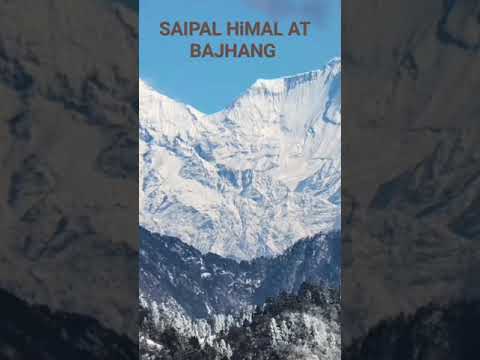
SAIPAL HIMAL AT BAJHANG DISTRICT
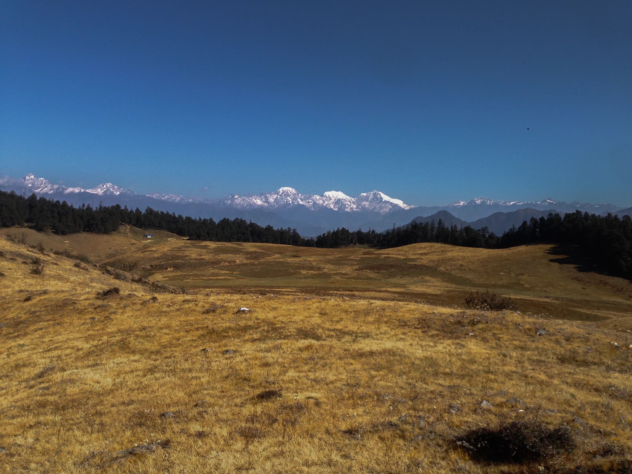
Mount Saipal (साइपाल हिमाल), rising to an imposing summit elevation of 7,031 metres (23,068 feet), is the second-highest peak in Sudurpashchim Province and the defining geographical landmark of Far-Western Nepal. Anchoring the rugged Gurans Himal massif on the northern boundary of Bajhang District (Saipal Rural Municipality), this glaciated colossus forms the high watershed between Bajhang, Humla, and Bajura, its ice battlements visible from vantage points across thousands of square kilometers of Western Nepal. Known affectionately as the 'Guardian of the Far West', Saipal holds profound mythological and cultural significance. Local Khas and Bhotiya mountain communities revere the glaciated peak as the sacred throne of guardian deities and celestial spirits. First successfully summited in 1963 by an Austrian expedition led by Dr. Rudolf Jonas, Mount Saipal remains one of the most technically demanding and remote climbing objectives in the Great Himalayan Range, celebrated for its massive hanging glaciers, steep avalanche-prone couloirs, and sheer rock towers. For adventurous trekkers, the trek to Saipal Base Camp (approx. 4,200m) offers an unparalleled wilderness expedition through untouched Himalayan valleys. Following the northern course of the Seti River through Dhalaun and Yangadhar, the route passes through traditional Bhotiya settlements, ancient sheep pastoral encampments, and untouched birch forests before emerging into a raw glacial amphitheater. Here, travelers are greeted by immense lateral moraines, active ice calvings, and unbroken vistas of the Saipal icefield beneath crisp azure skies.
Mount Saipal (साइपाल हिमाल), rising to an imposing summit elevation of 7,031 metres (23,068 feet), is the second-highest peak in Sudurpashchim Province and the defining geographical landmark of Far-Western Nepal. Anchoring the rugged Gurans Himal massif on the northern boundary of Bajhang District (Saipal Rural Municipality), this glaciated colossus forms the high watershed between Bajhang, Humla, and Bajura, its ice battlements visible from vantage points across thousands of square kilometers of Western Nepal. Known affectionately as the 'Guardian of the Far West', Saipal holds profound mythological and cultural significance. Local Khas and Bhotiya mountain communities revere the glaciated peak as the sacred throne of guardian deities and celestial spirits. First successfully summited in 1963 by an Austrian expedition led by Dr. Rudolf Jonas, Mount Saipal remains one of the most technically demanding and remote climbing objectives in the Great Himalayan Range, celebrated for its massive hanging glaciers, steep avalanche-prone couloirs, and sheer rock towers. For adventurous trekkers, the trek to Saipal Base Camp (approx. 4,200m) offers an unparalleled wilderness expedition through untouched Himalayan valleys. Following the northern course of the Seti River through Dhalaun and Yangadhar, the route passes through traditional Bhotiya settlements, ancient sheep pastoral encampments, and untouched birch forests before emerging into a raw glacial amphitheater. Here, travelers are greeted by immense lateral moraines, active ice calvings, and unbroken vistas of the Saipal icefield beneath crisp azure skies.
3 available
1 available
YouTube
SAIPAL HIMAL AT BAJHANG DISTRICT
Discover More

Chainpur Bazaar (चैनपुर बजार) is the historic administrative capital, cultural heart, and commercial trading center of Bajhang District, situated in a scenic valley bowl at an elevation of 1,280 metres at the confluence of the Bauli Gad and the West Seti River in Jaya Prithvi Municipality. Surrounded by terraced hillsides and framed by high mountain ridges, Chainpur is characterized by its stone-paved lanes, traditional multi-story slate-roofed buildings, and warm Far-Western hospitality. Historically, Chainpur served as the principal political and commercial crossroads of the Kingdom of Bajhang. It is celebrated as the ancestral home and administrative seat of Raja Jaya Prithvi Bahadur Singh (1877–1940), Nepal's 16th National Hero (Rastriya Bibhuti), visionary humanist, philosopher, and early educational reformer who championed civil liberties, established pioneering schools, and authored early civic textbooks here. Nearby royal heritage landmarks include the historic Hattisar Durbar and Bhojpur royal precinct. As the central urban and transit hub of Bajhang, Chainpur functions as the premier staging point and gateway for trekking expeditions venturing into Khaptad National Park, Surma Sarovar, and Mount Saipal Base Camp. The town offers travelers an authentic blend of Far-Western urban life, riverside suspension bridge crossings, local food culture, and direct road connectivity along the Jaya Prithvi Highway.

Khaptad National Park is one of Nepal's most distinctive protected areas, spanning four districts (Bajhang, Bajura, Achham, and Doti) in the far-western hills of Sudurpashchim Province. Unlike most Himalayan parks, Khaptad's defining landscape is a series of undulating sub-alpine meadows (patans) at 3,000 to 3,500 metres -- broad, rolling grasslands fringed by dense cedar and rhododendron forests. The park covers 225 square kilometres and protects an ecosystem with leopards, black bears, deer, wolves, and over 270 bird species. The meadows support rare medicinal herbs and wildflowers historically collected by the hermit-sage Khaptad Swami, who lived within the park's boundaries for decades until his death in 1996. His ashram and sacred sites within the park remain important Hindu pilgrimage destinations. The Triveni -- a confluence of three small rivers within the park -- is the most sacred point and attracts large numbers of pilgrims, especially during the Shivaratri festival. Several small lakes (dahals) dot the plateau, and views extend to the Api and Saipal Himalayan peaks on clear days. Access requires flights to Dhangadhi or Dipayal followed by road and foot travel. The most-used trekking routes enter from the Sanfebagar side in Achham district. Best visited from May to October when the meadows are green; snow makes access difficult in winter. An NP entry permit is required.

Surma Sarovar (सुर्मा सरोवर), revered across Far-Western Nepal as the Mini Kailash, is a pristine high-altitude glacial tarn situated at an elevation of 4,333 metres beneath the towering ice walls of the Gurans Himal in Surma Rural Municipality, Bajhang District. In regional Hindu cosmology, Surma Sarovar is revered as the divine abode of Goddess Surma Devi, a benevolent manifestation of Goddess Parvati. Local tradition holds that taking a sacred ablution in its crystal-clear emerald waters purifies devotees of lifetime sins and grants spiritual liberation. The lake is the epicenter of the legendary Birijat Mela, a biennial pilgrimage held during Janai Purnima (Bhadra Shukla Chaturdashi). Tens of thousands of devotees, ascetics, and shamanic mediums (Dhamis) from across Sudurpashchim and neighboring Uttarakhand undertake an arduous multi-day barefoot journey across high alpine ridges, glacial moraines, and scree passes without modern footwear, guided only by spiritual fortitude and traditional devotional hymns. Ceremonial copper pitchers containing holy waters from the lake are carried back down to ancestral village shrines to consecrate farmlands and livestock. Beyond its immense sacred value, Surma Sarovar is an exceptional alpine trekking wonderland. The approach leads through lush subtropical valleys, ancient deodar and rhododendron groves, before bursting onto high alpine meadows carpeted with rare Himalayan wildflowers and medicinal flora including yarsagumba (caterpillar fungus) and padmachal (Himalayan rhubarb). From the amphitheater surrounding the lake, trekkers enjoy breathtaking close-up vistas of glaciated horns and cascading icefalls, making it one of Nepal's most mesmerizing and spiritually charged wilderness journeys.

Annapurna Base Camp (ABC), situated within the dramatic Annapurna Sanctuary at 4,130 metres above sea level, is one of the most celebrated trekking destinations in the world. The sanctuary is a high glacial cirque ringed by some of the world's highest peaks: Annapurna I (8,091 m -- the 10th highest in the world), Annapurna South (7,219 m), Machhapuchhre (6,993 m), Hiunchuli (6,441 m), and Gangapurna (7,454 m). The standard trek to ABC starts from Nayapul near Pokhara and passes through the rhododendron forests of the Annapurna Conservation Area, the Gurung village of Ghandruk, the deep Modi Khola valley, and the dramatic bamboo corridor that leads into the sanctuary. The total round-trip trek typically takes 7 to 12 days depending on the route chosen. At base camp, trekkers are completely encircled by Himalayan giants. Sunrise at ABC, when the first golden light strikes the icy walls of Annapurna I directly above, is considered one of the greatest spectacles available on foot in Nepal. Required permits include the Annapurna Conservation Area Project (ACAP) entry permit and the TIMS card. Tea houses provide food and accommodation along the entire route. Altitude acclimatisation is important above 3,000 m. The route is dangerous during monsoon (June-August) when landslides are frequent. October-November and March-May are optimal seasons.

Annapurna North Base Camp, situated at an elevation of 4,190 metres in Annapurna Rural Municipality of Myagdi District, is one of the most historically monumental mountaineering sites in the world. It is the authentic base camp from which the legendary 1950 French expedition, led by Maurice Herzog and Louis Lachenal, achieved the first-ever ascent of an 8,000-metre mountain (Annapurna I, 8,091 m) on June 3, 1950 -- three years before Mount Everest was summited. Following decades of obscurity while commercial trekking focused on the southern sanctuary in Kaski, the historic northern route from Narchyang village was meticulously rediscovered, cleared, and opened as the "Maurice Herzog Trail" through community-led conservation efforts. The trek winds through deep river gorges, ancient virgin birch and bamboo forests, and dramatic glacial moraines along the Mistri Khola. At the base camp cirque, trekkers stand in an awe-inspiring glacial amphitheatre directly beneath the formidable North Face and glaciated ridges of Annapurna I, Nilgiri North, and Tilicho Peak. The site features the turquoise alpine waters of Panchakunda Lake, holy natural caves, and a commemorative monument honoring the pioneering 1950 mountaineers. It offers an authentic, rugged wilderness experience for adventurous trekkers.

Known as Ganesh Himal, and also called the Ganesh Himal Range, this magnificent Himalayan mountain range stretching across Dhading, Rasuwa, Gorkha, and Nuwakot districts is one of Nepal's most spectacular yet less-crowded trekking destinations. Named after Lord Ganesh, the Hindu deity of wisdom and prosperity, the snow-covered peaks are said to resemble the elephant-headed god, giving the range its sacred name. The highest summit, Ganesh I (Yangra), rises to 7,422 meters, accompanied by several other majestic peaks that dominate the northern skyline. The region is renowned for its pristine glaciers, alpine meadows, rhododendron forests, hidden valleys, and rich biodiversity, offering an untouched Himalayan experience far from the busier trekking routes. Trekkers pass through traditional Tamang and Gurung villages, ancient monasteries, and scenic mountain trails while enjoying breathtaking views of Langtang, Manaslu, and surrounding Himalayan ranges. Spring and autumn are the ideal seasons to visit, with blooming rhododendrons, crystal-clear skies, and comfortable trekking conditions. Whether you're seeking remote Himalayan adventures, extraordinary mountain photography, or an authentic cultural journey through Nepal's highlands, Ganesh Himal (Ganesh Himal Range) offers one of the country's most rewarding mountain experiences.