YouTube
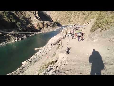
Introduction to the landscape, geography, and road corridors of Jitegada and Kotwada, Kalikot (Video: Bishisht Bhatta)
Perched dramatically on an expansive high-altitude natural mountain plateau above the southwestern Karnali River gorge, the Kotwada Citadel & Suntharali High Plateau (कोटवाडा कोट तथा सुन्थराली उच्च फाँट) in Naraharinath Rural Municipality is one of Kalikot's most picturesque and historic vantage points. The ridge was originally fortified by ancient Baise chieftains to guard strategic mountain passes connecting the Karnali basin with the Ramaroshan highlands of neighboring Achham. Today, this high tableland is home to the scenic Suntharali STOL Airport—the sole civil aviation airstrip in Kalikot—and acts as the premier staging point for the scenic wilderness trek connecting Kalikot to the 12 lakes and 18 meadows of Ramaroshan. Offering sweeping views of rugged canyons, cloud-filled valleys, and alpine ridges, Kotwada blends historic military heritage with high-altitude eco-trekking adventure.
Perched dramatically on an expansive high-altitude natural mountain plateau above the southwestern Karnali River gorge, the Kotwada Citadel & Suntharali High Plateau (कोटवाडा कोट तथा सुन्थराली उच्च फाँट) in Naraharinath Rural Municipality is one of Kalikot's most picturesque and historic vantage points. The ridge was originally fortified by ancient Baise chieftains to guard strategic mountain passes connecting the Karnali basin with the Ramaroshan highlands of neighboring Achham. Today, this high tableland is home to the scenic Suntharali STOL Airport—the sole civil aviation airstrip in Kalikot—and acts as the premier staging point for the scenic wilderness trek connecting Kalikot to the 12 lakes and 18 meadows of Ramaroshan. Offering sweeping views of rugged canyons, cloud-filled valleys, and alpine ridges, Kotwada blends historic military heritage with high-altitude eco-trekking adventure.
1 available
1 available
YouTube
Introduction to the landscape, geography, and road corridors of Jitegada and Kotwada, Kalikot (Video: Bishisht Bhatta)
Discover More

Perched dramatically on a commanding mountain promontory high above the deep gorges of the Karnali and Tila rivers, the Khandachakra Manma Historic Ridge (खाँडाचक्र मान्मा ऐतिहासिक गढी तथा पञ्चदेवल) serves as the cultural, historical, and geographic heart of Kalikot. This strategic ridge preserves the ancient stone fortifications of Manma Kot and Purna Kot, alongside the Department of Archaeology-cataloged Manma Panchadewal—a cluster of medieval Khas-Malla stone shikhara-style spire shrines exhibiting master dry-masonry craftsmanship from the Katyuri kingdom era. Towering above the settlement is the sacred peak of Chuli Malika, offering sweeping 360-degree panoramic vistas of the winding Karnali Highway and distant snow-capped Himalayan summits. Walking through this historic ridge offers travelers an authentic immersion into Western Nepal's ancient kingdom roots, traditional stone-and-timber architecture, and dramatic mountain geography.

Cascading down a colossal amphitheater of vertical red limestone cliffs in northern Kalikot, Pachal Waterfall (पचाल झरना) is officially recognized as one of the tallest waterfalls in Nepal and South Asia, with an officially measured vertical plunge of 381 meters. Selected by the Government of Nepal as one of the country's Top 100 Flagship Destinations, this awe-inspiring natural wonder pours continuous glacial runoff from the high alpine passes of northern Kalikot into the Karnali river basin. The thundering cascade generates perpetual rainbow mists and cool mountain breezes that envelope the surrounding pine forests and terraced hamlet of Khardu. Visitors hike along newly constructed stone pathways equipped with safety railings and observation pavilions, with welcoming community homestays in Khardu providing authentic Khas hospitality, organic millet rotis, and local mountain honey.

Nestled on an expansive agricultural and historical shelf overlooking the Karnali canyon, Raskot (रास्कोट प्राचीन दरबार तथा कोट क्षेत्र) was the ancestral royal citadel and sovereign seat of the medieval Raskoti kings—one of the foundational principalities of the Baise Rajya confederacy. The citadel complex preserves ancient palace foundations, defensive stone ramparts, stone-paved courtyards, and centuries-old royal spring fountains (Naula) built during the golden age of western Khas rule. Raskot's higher ridges cradle the sacred Deura Malika shrine and subalpine meadows, which serve as the northern spiritual staging route for pilgrims bound for Badimalika. Retaining tightly clustered Khas vernacular settlements with intricately carved wooden pillars and slate roofs, Raskot provides an extraordinary journey into medieval Himalayan statehood, folklore, and rural living heritage.

Known as Ama Yangri Peak, and also called Ama Yangri or Ama Yangri Danda, this spectacular Himalayan viewpoint in the Helambu region of Sindhupalchok district is one of Nepal's finest short trekking destinations. Rising to an elevation of approximately 3,771 meters, the peak is revered by the local Hyolmo (Yolmo) community, who consider it a sacred mountain blessed by a protective mother deity, from which the name "Ama" (Mother) is derived. The trek to the summit passes through enchanting rhododendron and pine forests, colorful prayer flags, traditional monasteries, and peaceful Hyolmo villages, offering a perfect blend of natural beauty and cultural heritage. From the summit, visitors are rewarded with breathtaking 360-degree panoramic views of the Langtang, Jugal Himal, Dorje Lakpa, Ganesh Himal, Gaurishankar, and even Mount Everest on exceptionally clear days. The peak is especially famous for its mesmerizing sunrise, when the first rays of light illuminate the snow-capped Himalayas in brilliant shades of gold and orange. Spring and autumn provide the best trekking conditions, with blooming rhododendrons, pleasant weather, and crystal-clear mountain vistas. Whether you're seeking a rewarding Himalayan hike, spectacular photography, or a peaceful spiritual escape, Ama Yangri Peak (Ama Yangri/Ama Yangri Danda) offers one of the most unforgettable viewpoints in central Nepal.

Australian Camp, historically known as Thula Kharka (Great Pasture), is a renowned scenic ridge viewpoint and serene trekking settlement situated at an elevation of 2,060 metres in Kaski. Located along the ridge above Kande village and Dhampus, the site gained its popular name in the 1990s when Austrian (and later Australian) expeditioners utilized the expansive meadow as a peaceful base. The camp offers an unobstructed 360-degree panorama of the central Himalayas, providing close-up perspectives of Annapurna South, Hiunchuli, Machhapuchhre, and Lamjung Himal rising dramatically above the Modi Khola valley. The sunrise and sunset from the camp's grassy ridge crest are legendary, illuminating snow giants against alpine skies. Accessible via an easy 1.5 to 2-hour uphill hike through rhododendron and oak forests from Kande highway, Australian Camp serves as an ideal introductory day-hike, family trek, or launching point for the Mardi Himal and Dhampus circuit trails. Well-appointed lodges and camping grounds provide comfortable mountain hospitality.

The Badagaun-Kaiyan Suspension Bridge (frequently referred to as the Kushma-Mudikuwa Bridge or Kaiya Suspension Bridge), spanning between Badagaun in Kusma Municipality and Kaiyan/Mudikuwa on the southern canyon plateau, is among the highest pedestrian suspension footbridges in Nepal and all of South Asia. Completed in 2013 AD (2070 BS) across the deepest section of the Modi Khola gorge, the footbridge measures 359 metres (1,178 feet) in length and hangs suspended at a staggering elevation of 156 metres (512 feet) above the river. The bridge was engineered as part of a visionary initiative to overcome the severe topographic isolation of southern Parbat's agricultural communities. Its soaring height easily surpasses ordinary suspension bridges, creating an imposing silhouette that seems almost gossamer-thin against the vast canyon landscape. Crossing the bridge gives visitors the sensation of walking through open air, accompanied by the distant roar of the Modi River echoing off vertical limestone rock faces far below. Along with its sister crossing at Gyadi and the Kali Gandaki bridge to Baglung, the Badagaun-Kaiyan bridge forms part of the renowned 'Bridge Circuit' of Kushma. Travelers often undertake a loop walk connecting all three mega-bridges in a single afternoon, experiencing three distinct canyon perspectives, panoramic mountain vistas, and the unique cultural life of the cliff-top settlements flanking the district headquarters.