YouTube
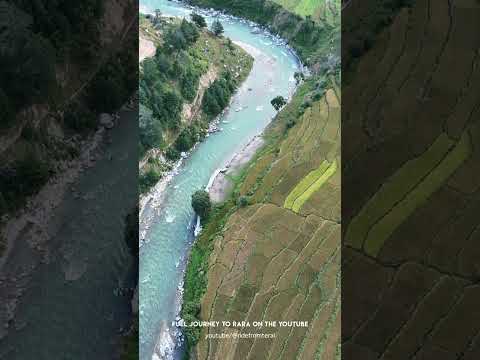
Karnali River drone views and dramatic mountain ridges in Kalikot on the road to Rara (Video: Ride from Terai)
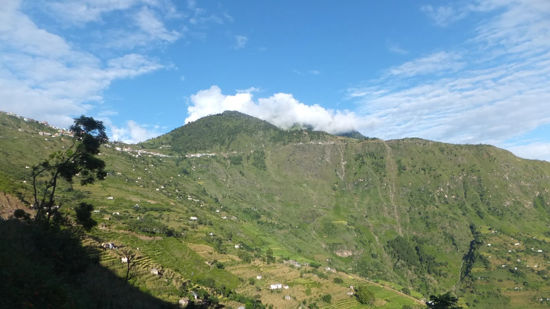
Perched dramatically on a commanding mountain promontory high above the deep gorges of the Karnali and Tila rivers, the Khandachakra Manma Historic Ridge (खाँडाचक्र मान्मा ऐतिहासिक गढी तथा पञ्चदेवल) serves as the cultural, historical, and geographic heart of Kalikot. This strategic ridge preserves the ancient stone fortifications of Manma Kot and Purna Kot, alongside the Department of Archaeology-cataloged Manma Panchadewal—a cluster of medieval Khas-Malla stone shikhara-style spire shrines exhibiting master dry-masonry craftsmanship from the Katyuri kingdom era. Towering above the settlement is the sacred peak of Chuli Malika, offering sweeping 360-degree panoramic vistas of the winding Karnali Highway and distant snow-capped Himalayan summits. Walking through this historic ridge offers travelers an authentic immersion into Western Nepal's ancient kingdom roots, traditional stone-and-timber architecture, and dramatic mountain geography.
Perched dramatically on a commanding mountain promontory high above the deep gorges of the Karnali and Tila rivers, the Khandachakra Manma Historic Ridge (खाँडाचक्र मान्मा ऐतिहासिक गढी तथा पञ्चदेवल) serves as the cultural, historical, and geographic heart of Kalikot. This strategic ridge preserves the ancient stone fortifications of Manma Kot and Purna Kot, alongside the Department of Archaeology-cataloged Manma Panchadewal—a cluster of medieval Khas-Malla stone shikhara-style spire shrines exhibiting master dry-masonry craftsmanship from the Katyuri kingdom era. Towering above the settlement is the sacred peak of Chuli Malika, offering sweeping 360-degree panoramic vistas of the winding Karnali Highway and distant snow-capped Himalayan summits. Walking through this historic ridge offers travelers an authentic immersion into Western Nepal's ancient kingdom roots, traditional stone-and-timber architecture, and dramatic mountain geography.
3 available
1 available
YouTube
Karnali River drone views and dramatic mountain ridges in Kalikot on the road to Rara (Video: Ride from Terai)
Discover More

Perched dramatically on an expansive high-altitude natural mountain plateau above the southwestern Karnali River gorge, the Kotwada Citadel & Suntharali High Plateau (कोटवाडा कोट तथा सुन्थराली उच्च फाँट) in Naraharinath Rural Municipality is one of Kalikot's most picturesque and historic vantage points. The ridge was originally fortified by ancient Baise chieftains to guard strategic mountain passes connecting the Karnali basin with the Ramaroshan highlands of neighboring Achham. Today, this high tableland is home to the scenic Suntharali STOL Airport—the sole civil aviation airstrip in Kalikot—and acts as the premier staging point for the scenic wilderness trek connecting Kalikot to the 12 lakes and 18 meadows of Ramaroshan. Offering sweeping views of rugged canyons, cloud-filled valleys, and alpine ridges, Kotwada blends historic military heritage with high-altitude eco-trekking adventure.

Cascading down a colossal amphitheater of vertical red limestone cliffs in northern Kalikot, Pachal Waterfall (पचाल झरना) is officially recognized as one of the tallest waterfalls in Nepal and South Asia, with an officially measured vertical plunge of 381 meters. Selected by the Government of Nepal as one of the country's Top 100 Flagship Destinations, this awe-inspiring natural wonder pours continuous glacial runoff from the high alpine passes of northern Kalikot into the Karnali river basin. The thundering cascade generates perpetual rainbow mists and cool mountain breezes that envelope the surrounding pine forests and terraced hamlet of Khardu. Visitors hike along newly constructed stone pathways equipped with safety railings and observation pavilions, with welcoming community homestays in Khardu providing authentic Khas hospitality, organic millet rotis, and local mountain honey.

Nestled on an expansive agricultural and historical shelf overlooking the Karnali canyon, Raskot (रास्कोट प्राचीन दरबार तथा कोट क्षेत्र) was the ancestral royal citadel and sovereign seat of the medieval Raskoti kings—one of the foundational principalities of the Baise Rajya confederacy. The citadel complex preserves ancient palace foundations, defensive stone ramparts, stone-paved courtyards, and centuries-old royal spring fountains (Naula) built during the golden age of western Khas rule. Raskot's higher ridges cradle the sacred Deura Malika shrine and subalpine meadows, which serve as the northern spiritual staging route for pilgrims bound for Badimalika. Retaining tightly clustered Khas vernacular settlements with intricately carved wooden pillars and slate roofs, Raskot provides an extraordinary journey into medieval Himalayan statehood, folklore, and rural living heritage.

Ajayamerukot is a monumental medieval archaeological citadel and palace complex established in the 13th to 14th century CE as the royal winter capital of the Katyuri and Doti Rainka Kings. Perched defensively atop an isolated mountain spur in Ward 2 of Ajaymeru Rural Municipality at an altitude of 1,313 metres, the site is bordered on three sides by sheer ravines carved by the Chamdola and Baunera streams. The extensive archaeological precinct preserves the foundation platforms of a multi-tiered stone royal palace, expansive paved courtyards, an assembly hall (Baithak), carved Shikhara-style stone dewals, and defensive ramparts. An exceptional architectural marvel of the site is the subterranean Rani Naula (रानी नाउला), an intricately dressed stone step-well featuring arched corridors and classical Katyuri decorative friezes. Recognized as an official Department of Archaeology monument under ID NP-DD-04 and nominated on Nepal's UNESCO World Heritage Tentative List, Ajayamerukot stands as one of the most significant medieval monarchical complexes in the Himalayas.

Alapeshwar Cave (locally known as Alpeswor Gupha or Alapu Cave), nestled within the forested hills of Kusma Municipality Ward 7 near Gyadichaur and the Silmi forest corridor, is an extraordinary natural speleological cave network in Parbat District. Discovered in recent decades by local community members, the cave extends several hundred metres into subterranean limestone bedrock, offering an intriguing subterranean exploration destination for eco-tourists and adventure travelers. The interior of Alapeshwar Cave features multiple natural limestone chambers linked by winding rock corridors. Over tens of thousands of years, mineral-rich seepage water has sculpted spectacular calcite formations, including delicate stalactites hanging from cavern ceilings, massive stalagmites rising from the floor, flowstone curtains, and crystalline rock terraces. In several chambers, clear subterranean spring water flows over the smooth limestone floor, creating natural underground wading pools and tranquil echo chambers. Local development committees have installed solar-powered illumination along the main walking galleries, safe metal ladders, and protective handrails to facilitate visitor access without disturbing the delicate cave ecology and resident microbat colonies. Unlike heavily visited commercial caves, Alapeshwar retains a raw, uncommercialized subterranean ambiance that rewards curious travelers exploring the diverse canyon landscape of Kushma.

Amargadhi Fort is a monumental late 18th-century stone military fortification perched at an elevation of 1,901 metres along the crest of the Mahabharat range in Khalanga, Dadeldhura. Constructed in 1790 CE (1847 BS) by Gorkhali Commander Bada Kaji Amar Singh Thapa following the unification of the Far-Western hill principalities, the citadel commanded vital strategic mountain trade and troop routes between Doti, Kumaon, and the Mahakali basin. Enclosed by massive stone bastion ramparts punctuated with defensive cannon embrasures, the inner fortress encompasses twenty-two subterranean vaulted chambers that served as troop barracks and munitions depots, a central Kotghar armory, and a shrine dedicated to Ugra Bhairav. Cataloged under Department of Archaeology monument identification NP-DD-08, the citadel offers sweeping panoramic vistas across the terraced valleys and surrounding pine-clad ridges.