YouTube
Surkhet Kankrebihar Documentary and History | Guras Khabar
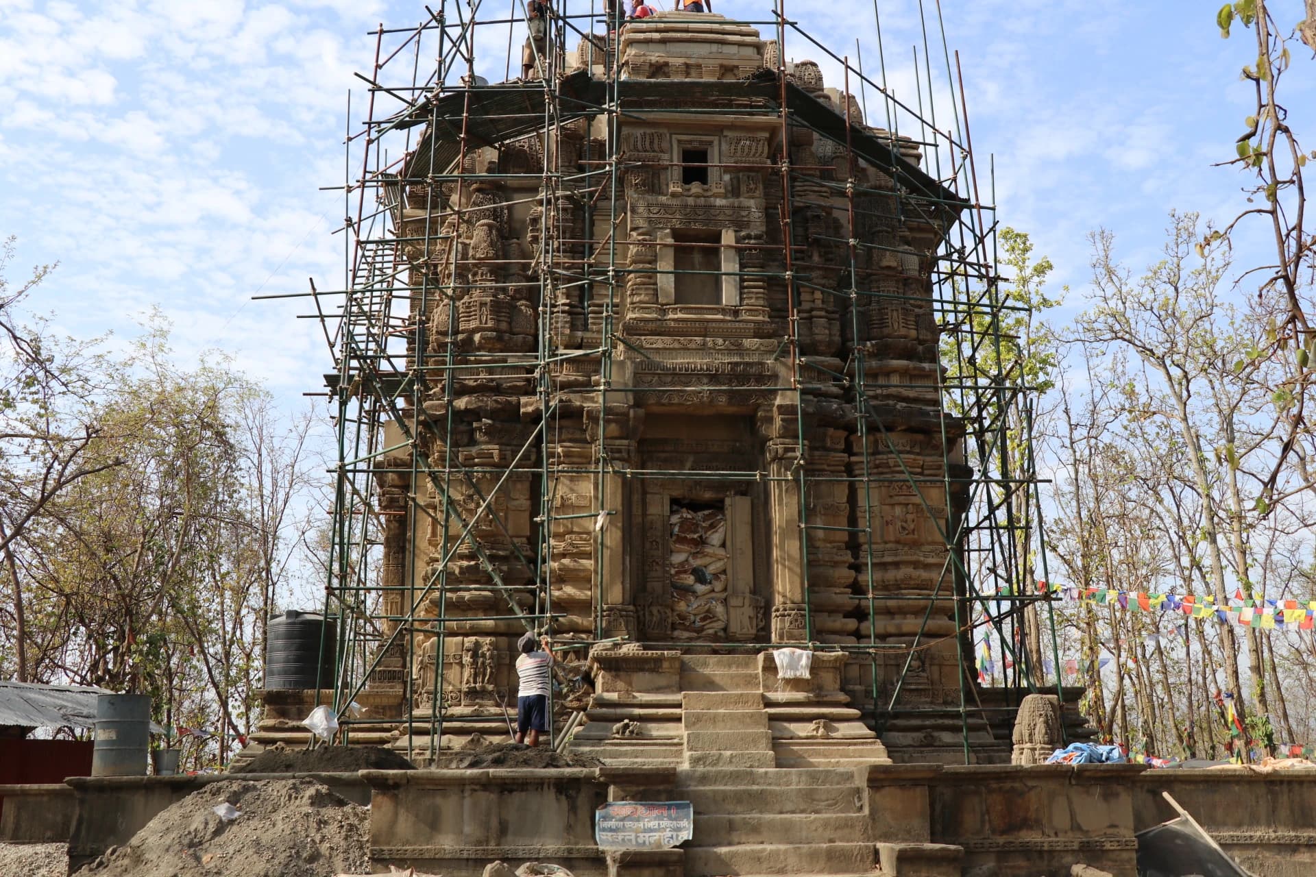
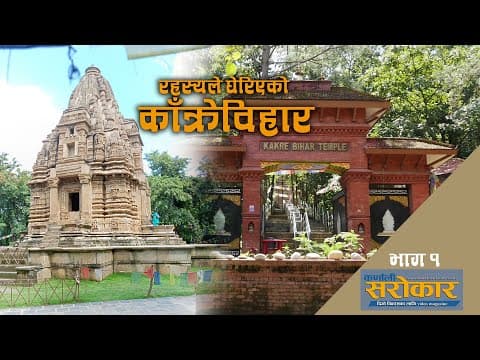
Kakre Bihar (काँक्रेविहार), situated atop a forested hillock in Birendranagar Municipality-11, is a monumental 12th-century archaeological masterpiece celebrated as the 'Lumbini of Western Nepal' and the premier cultural heritage landmark of Karnali Province. Constructed during the zenith of the medieval Khas-Malla Empire under King Krachalla and his successors, Kakre Bihar originally stood as an extraordinary syncretic Shikhara-style stone temple and Buddhist monastic complex. Discovered in ruins in the late 20th century, the monument was meticulously excavated and reassembled by the Department of Archaeology using anastylosis, re-erecting hundreds of original hand-carved stone blocks adorned with intricate bas-relief carvings of Gautama Buddha, Bodhisattvas, Saraswati, and Hindu deities alongside floral friezes. The temple is ensconced within a peaceful 175-hectare protected biodiversity forest reserve where spotted deer, barking deer, wild boars, and diverse sub-tropical birdlife roam freely under dense sal canopies. Located just five kilometers south of central Birendranagar, Kakre Bihar offers travelers an inspiring blend of deep archaeological history, sacred art, and tranquil woodland walking trails.
Kakre Bihar (काँक्रेविहार), situated atop a forested hillock in Birendranagar Municipality-11, is a monumental 12th-century archaeological masterpiece celebrated as the 'Lumbini of Western Nepal' and the premier cultural heritage landmark of Karnali Province. Constructed during the zenith of the medieval Khas-Malla Empire under King Krachalla and his successors, Kakre Bihar originally stood as an extraordinary syncretic Shikhara-style stone temple and Buddhist monastic complex. Discovered in ruins in the late 20th century, the monument was meticulously excavated and reassembled by the Department of Archaeology using anastylosis, re-erecting hundreds of original hand-carved stone blocks adorned with intricate bas-relief carvings of Gautama Buddha, Bodhisattvas, Saraswati, and Hindu deities alongside floral friezes. The temple is ensconced within a peaceful 175-hectare protected biodiversity forest reserve where spotted deer, barking deer, wild boars, and diverse sub-tropical birdlife roam freely under dense sal canopies. Located just five kilometers south of central Birendranagar, Kakre Bihar offers travelers an inspiring blend of deep archaeological history, sacred art, and tranquil woodland walking trails.
3 available
1 available
YouTube
Surkhet Kankrebihar Documentary and History | Guras Khabar
Discover More

The Bheri River Rafting Corridor (भेरी नदी जलयात्रा तथा साहसिक करिडोर), traversing the rugged southern canyons of Surkhet District across Bheriganga, Gurbhakot, and Barahatal municipalities, is celebrated internationally as one of Nepal's finest multi-day white-water river adventures and sport angling destinations. Originating high in the glaciated ridges of the Dhaulagiri and Kanjiroba massifs, the Bheri River carves through untamed subtropical valleys, towering limestone bluffs, pristine sal forests, and expansive white sand beaches before uniting with the Karnali River at Kuneghat. The Surkhet section features thrilling Class III and Class IV rapids interspersed with gentle, glassy turquoise pools ideal for beginner and experienced rafters, kayakers, and wilderness campers alike. In addition to exhilarating white-water navigation, the Bheri River is globally acclaimed as a prime habitat for the endangered Golden Mahseer (Tor putitora), attracting catch-and-release sport anglers from around the world. Multi-day river expeditions offer secluded riverside wilderness camping under starlit skies, canyon birdwatching (including endangered river lapwings and fish eagles), and an intimate look at the indigenous fishing lifestyles of the Raji and Majhi river communities.

Bulbule Lake (बुलबुले ताल तथा पर्या-पर्यटन पार्क), located in Birendranagar Municipality-10, is Surkhet's most iconic natural landmark and recreational eco-park, eternally celebrated across Nepal through the classic folk song 'Surkhetma Bulbule Taal...'. Spanning approximately 28 bighas, the park derives its name from the continuous, natural underground freshwater springs that bubble ('bulbule') up through the subterranean gravel beds to feed the lake. The site has been developed into a scenic urban wetland and botanical sanctuary featuring an expansive boating lake where visitors can paddle across calm waters, traditional stone water spouts (dhunge dhara) flowing with pure artesian spring water, manicured flower gardens, and shaded picnic groves. Serving as the social and ecological heart of the provincial capital, Bulbule Lake is an essential stop for families, travelers acclimating in Birendranagar, and nature lovers seeking relaxed afternoon strolls along weeping willow trees and lotus pools with sweeping views of the surrounding Surkhet hills.

Deuti Bajai Temple (देउती बज्यै मन्दिर), situated in Birendranagar Municipality-11, is the foremost historic Hindu pilgrimage temple and spiritual guardian shrine of Surkhet District and the wider Bheri river valley. Dedicated to Goddess Deuti Bajai, a revered manifestation of Goddess Durga/Bhagwati, the temple is steeped in ancient folklore dating back to the Khas kingdom era. According to regional legend, the shrine was originally consecrated around a holy self-manifested stone discovered along the Bheri riverbanks by the indigenous Raji people—an ancient semi-nomadic riverine tribe of western Nepal—who served as the shrine's hereditary priests and protectors for centuries. Devotees from across Karnali, Lumbini, and Sudurpashchim provinces visit the temple to offer worship, seek blessings for fulfillment of personal vows, and pray for safe journeys before embarking along the arduous mountain highways toward Jumla, Rara, and Dolpa. The temple precinct buzzes with devotional fervor during Sharadiya Navaratri and Chaitra Dashain, when thousands gather to witness traditional animal rituals, ceremonial drumming, and sacred offerings in its verdant red-brick courtyards.

Ajayamerukot is a monumental medieval archaeological citadel and palace complex established in the 13th to 14th century CE as the royal winter capital of the Katyuri and Doti Rainka Kings. Perched defensively atop an isolated mountain spur in Ward 2 of Ajaymeru Rural Municipality at an altitude of 1,313 metres, the site is bordered on three sides by sheer ravines carved by the Chamdola and Baunera streams. The extensive archaeological precinct preserves the foundation platforms of a multi-tiered stone royal palace, expansive paved courtyards, an assembly hall (Baithak), carved Shikhara-style stone dewals, and defensive ramparts. An exceptional architectural marvel of the site is the subterranean Rani Naula (रानी नाउला), an intricately dressed stone step-well featuring arched corridors and classical Katyuri decorative friezes. Recognized as an official Department of Archaeology monument under ID NP-DD-04 and nominated on Nepal's UNESCO World Heritage Tentative List, Ajayamerukot stands as one of the most significant medieval monarchical complexes in the Himalayas.

Alapeshwar Cave (locally known as Alpeswor Gupha or Alapu Cave), nestled within the forested hills of Kusma Municipality Ward 7 near Gyadichaur and the Silmi forest corridor, is an extraordinary natural speleological cave network in Parbat District. Discovered in recent decades by local community members, the cave extends several hundred metres into subterranean limestone bedrock, offering an intriguing subterranean exploration destination for eco-tourists and adventure travelers. The interior of Alapeshwar Cave features multiple natural limestone chambers linked by winding rock corridors. Over tens of thousands of years, mineral-rich seepage water has sculpted spectacular calcite formations, including delicate stalactites hanging from cavern ceilings, massive stalagmites rising from the floor, flowstone curtains, and crystalline rock terraces. In several chambers, clear subterranean spring water flows over the smooth limestone floor, creating natural underground wading pools and tranquil echo chambers. Local development committees have installed solar-powered illumination along the main walking galleries, safe metal ladders, and protective handrails to facilitate visitor access without disturbing the delicate cave ecology and resident microbat colonies. Unlike heavily visited commercial caves, Alapeshwar retains a raw, uncommercialized subterranean ambiance that rewards curious travelers exploring the diverse canyon landscape of Kushma.

Amargadhi Fort is a monumental late 18th-century stone military fortification perched at an elevation of 1,901 metres along the crest of the Mahabharat range in Khalanga, Dadeldhura. Constructed in 1790 CE (1847 BS) by Gorkhali Commander Bada Kaji Amar Singh Thapa following the unification of the Far-Western hill principalities, the citadel commanded vital strategic mountain trade and troop routes between Doti, Kumaon, and the Mahakali basin. Enclosed by massive stone bastion ramparts punctuated with defensive cannon embrasures, the inner fortress encompasses twenty-two subterranean vaulted chambers that served as troop barracks and munitions depots, a central Kotghar armory, and a shrine dedicated to Ugra Bhairav. Cataloged under Department of Archaeology monument identification NP-DD-08, the citadel offers sweeping panoramic vistas across the terraced valleys and surrounding pine-clad ridges.