YouTube
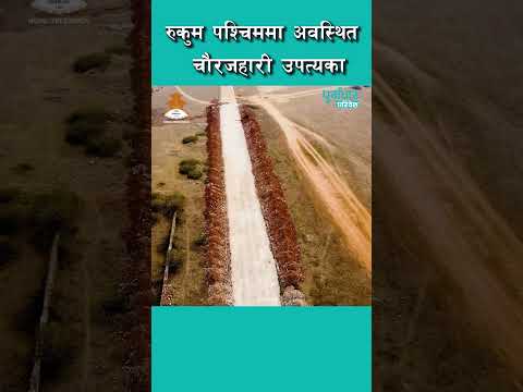
Aerial drone flight and panoramic showcase of Chaurjahari Valley, Rukum West (Video: Purbadhar Paribesh)
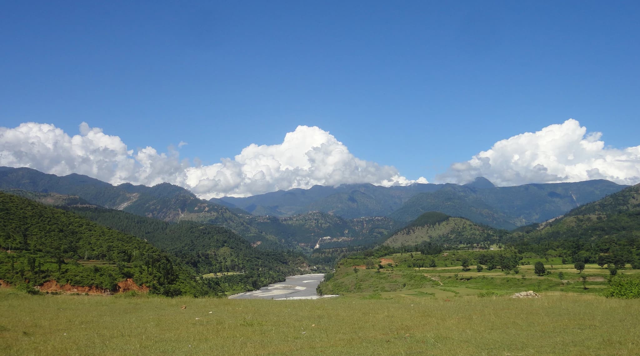
Spread across an expansive subtropical plateau along the eastern banks of the Bheri River, Chaurjahari Valley (चौरजहारी उपत्यका) is the largest and most striking flat river plain in the mountainous Karnali Province. Perched at an agreeable elevation of approximately 780 meters, this fertile agricultural wonderland is renowned as the breadbasket of Western Rukum, blanketed with flourishing paddy fields, golden wheat terraces, and sun-ripened citrus orchards. The Government of Nepal has designated Chaurjahari as one of the ten model Smart New Cities along the Mid-Hill Highway corridor, blending historic Newari-influenced bazaar quarters with modern town planning. The valley offers sweeping views of the turquoise Bheri River winding beneath rugged limestone cliffs, historic pedestrian suspension bridges linking Rukum West with Jajarkot, and panoramic vantage points from the surrounding hilltops.
Spread across an expansive subtropical plateau along the eastern banks of the Bheri River, Chaurjahari Valley (चौरजहारी उपत्यका) is the largest and most striking flat river plain in the mountainous Karnali Province. Perched at an agreeable elevation of approximately 780 meters, this fertile agricultural wonderland is renowned as the breadbasket of Western Rukum, blanketed with flourishing paddy fields, golden wheat terraces, and sun-ripened citrus orchards. The Government of Nepal has designated Chaurjahari as one of the ten model Smart New Cities along the Mid-Hill Highway corridor, blending historic Newari-influenced bazaar quarters with modern town planning. The valley offers sweeping views of the turquoise Bheri River winding beneath rugged limestone cliffs, historic pedestrian suspension bridges linking Rukum West with Jajarkot, and panoramic vantage points from the surrounding hilltops.
3 available
1 available
YouTube
Aerial drone flight and panoramic showcase of Chaurjahari Valley, Rukum West (Video: Purbadhar Paribesh)
Discover More

Located at Tharpu in Musikot Municipality, Digre Sai Kumari Bhagawati Temple (डिग्रे शाईकुमारी भगवती मन्दिर) is one of the most revered and ancient Shakta pilgrimage shrines in Western Nepal, cataloged under national archaeological monument inventory NP-RK-06. The sanctuary enshrines a sacred manifestation of Goddess Durga and houses a historic bronze temple bell dating back to 1641 BS (1584 CE). According to sacred local legend, the subterranean inner sanctum contains a natural limestone fissure traditionally believed to connect directly to the waters of the sacred Sani Bheri River. The temple is the focal point of an immense five-day religious fair held annually from Haribodhini Ekadashi to Kartik Purnima, drawing tens of thousands of pilgrims from across Karnali and Lumbini provinces. During the festival, devotees participate in vibrant spiritual rites and witness the iconic Sagal Nach (martial stick dance), creating an unforgettable cultural and spiritual spectacle.

Perched dramatically along a high mountain spine commanding the Sani Bheri river basin, the Musikot Khalanga Historic Ridge (मुसिकोट खलङ्गा ऐतिहासिक गढी) represents the historical and administrative heart of Rukum West. This strategic hilltop was the fortified citadel seat of the medieval Musikoti Rajas, one of the prominent principalities of the Baise Rajya confederacy before its incorporation into unified Nepal in 1787 CE. The ridge preserves the historic ruins of Musikot Durbar, ancient defensive stone bastions, and the royal palace temple complex restored under archaeological oversight. Walking along the traditional stone-paved paths through the old Khalanga settlement, visitors encounter distinctive vernacular stone masonry architecture, panoramic 360-degree viewpoints stretching north toward the snow-capped Sisne range, and rich cultural lore surrounding the founder-maid Musi and the martial history of the Karnali hills.

Nestled among the terraced hills of Banfikot in Rukum West, Syarpu Lake (स्यार्पू ताल) is the premier freshwater gem of the Mid-Western hills. Spanning a water surface of approximately 49 hectares within a wider 2.6-square-kilometer catchment basin, this serene body of water reflects rolling green pine ridges and terraced village farms. The lake is fed by pristine natural springs and the cascading waters of the Simaichhari waterfall, supporting thriving local carp fisheries and vibrant biodiversity. Visitors can glide across its tranquil turquoise waters on traditional wooden rowboats, hike scenic rim trails connecting lakeside homestays, and savor fresh local fish prepared by welcoming Magar and Chhetri communities. The annual Syarpu Tourism Festival celebrates the lake's cultural and ecological prominence, making it an essential eco-tourism and nature retreat in Karnali Province.

Known as the world's deepest river valley, Arun Valley is one of Nepal's most spectacular natural landscapes, carved by the mighty Arun River between the towering peaks of Mount Makalu and Mount Everest. This breathtaking valley is renowned for its dramatic scenery, where lush subtropical forests gradually rise to alpine meadows and snow-capped Himalayan mountains. As part of the Makalu Barun region, it is exceptionally rich in biodiversity, providing habitat for rare wildlife, colorful birds, and countless species of orchids and medicinal plants. The valley is also home to diverse ethnic communities, including the Rai, Sherpa, and Bhote, allowing visitors to experience authentic Himalayan culture and warm local hospitality. Popular among trekkers and adventure enthusiasts, Arun Valley offers scenic trails, suspension bridges, cascading waterfalls, and unforgettable views of the eastern Himalayas. Its untouched beauty, peaceful environment, and ecological significance make it one of Nepal's finest eco-tourism destinations. Whether you're seeking thrilling adventures, breathtaking mountain landscapes, or an authentic cultural experience, Arun Valley offers an unforgettable journey into the heart of eastern Nepal.

Flowing naturally along the dramatic banks of the Tila River, the Jumla Tatopani Natural Geothermal Springs (जुम्ला तातोपानी प्राकृतिक तातोपानी धारा) is Western Nepal's most celebrated balneological wellness and hydrothermal destination. Emanating directly from subterranean geological fissures, the mineral-rich geothermal springs discharge water at a consistent, soothing temperature of 40°C to 45°C throughout all seasons, even during freezing Himalayan winter snowfalls. Rich in sulfur, calcium, and revitalizing volcanic minerals, the waters are renowned throughout Karnali for their natural therapeutic and curative properties against rheumatoid arthritis (baat rog), joint inflammation, sciatica, and chronic skin ailments. The site features dedicated segregated stone-lined communal bathing spouts and immersion pools maintained by Tatopani Rural Municipality. Located conveniently adjacent to the Karnali Highway corridor, it provides travelers with a deeply restorative natural hot spring experience surrounded by whispering pine forests and rushing mountain waters.

The Kali Gandaki River Gorge (also known as the Andha Galchhi) is widely recognized as the deepest gorge in the world, measuring an astounding vertical depth of over 5,500 metres (approximately 18,000 feet). The gorge is sliced clean through the main Himalayan axis between two of the planet's highest eight-thousand-metre giants: Mount Dhaulagiri (8,167m) to the west and Mount Annapurna I (8,091m) to the east, while the rushing riverbed at Kowang and Dana lies at barely 2,500 metres elevation. Geologically, the Kali Gandaki is an antecedent river that existed before the rise of the Himalayas, cutting through the rising tectonic plateau over millions of years. The river canyon acts as a colossal meteorological funnel, generating legendary howling southern winds every afternoon that sweep through the valley. The gravel riverbeds of the Kali Gandaki are famous worldwide as the exclusive source of sacred Shaligram (Saligram) stones—fossilized black ammonite shells dating back over 150 million years to the prehistoric Tethys Sea. Revered by Hindus worldwide as the living manifestation of Lord Vishnu, these fossils make the gorge a site of profound theological, geological, and trekking wonder.