YouTube
Panchadewal Mandir Binayak Achham | 700 Years Old Historical Stone Temples
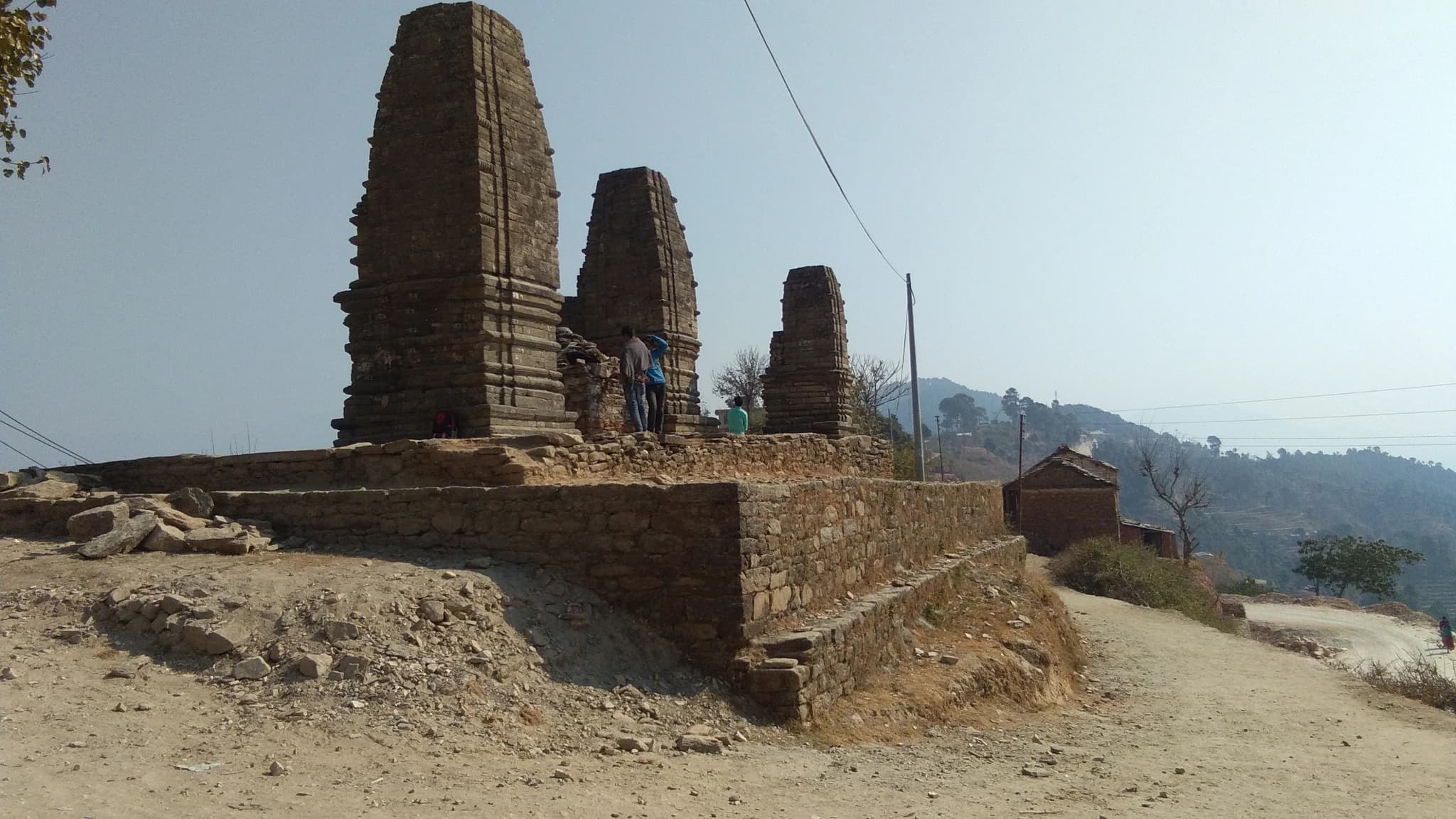
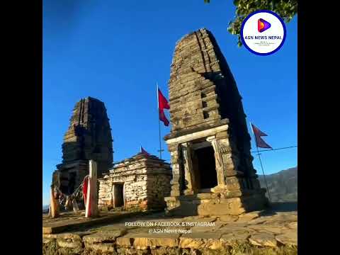
Binayak Panchadewal (विनायक पञ्चदेवल — Five Temples of Binayak) is a magnificent group of five medieval dry-stone Shikhara-style beehive temples situated in Panchadewal Binayak Municipality-3, Achham District, along the historic Mid-Hill Highway at an elevation of 1,345 metres. Listed as a protected national monument by the Department of Archaeology (DOA), this architectural masterpiece stands as one of the most significant and intact archaeological relics of the medieval Khas-Malla Empire in western Nepal. An ancient stone inscription carved into the monumental lintels records that these five Shikhara devals were constructed in Saka Era 1212 (1337 BS / 1290 CE) during the reign of Khas King Akshay Malla (अक्षय मल्ल). Renowned historian and antiquarian Yogi Naraharinath extensively documented the site, deciphering its Khas script inscriptions and linking the monuments to the imperial stone-masonry traditions centered at the Sinja capital of the Khas Kingdom. Each deval is erected with precision dry-stone masonry, featuring intricately carved doorframes, floral relief motifs, geometric lintels, and crowning ribbed stone amalaka capitals. Standing gracefully on a raised stone terrace in the heart of Binayak town, the monuments provide invaluable archaeological insight into the artistic heights, Shaivite devotional practices, and architectural engineering of 13th-century Western Nepal. The site is easily accessible to cultural travelers traversing the Mid-Hill Highway connecting Karnali and Sudurpashchim.
Binayak Panchadewal (विनायक पञ्चदेवल — Five Temples of Binayak) is a magnificent group of five medieval dry-stone Shikhara-style beehive temples situated in Panchadewal Binayak Municipality-3, Achham District, along the historic Mid-Hill Highway at an elevation of 1,345 metres. Listed as a protected national monument by the Department of Archaeology (DOA), this architectural masterpiece stands as one of the most significant and intact archaeological relics of the medieval Khas-Malla Empire in western Nepal. An ancient stone inscription carved into the monumental lintels records that these five Shikhara devals were constructed in Saka Era 1212 (1337 BS / 1290 CE) during the reign of Khas King Akshay Malla (अक्षय मल्ल). Renowned historian and antiquarian Yogi Naraharinath extensively documented the site, deciphering its Khas script inscriptions and linking the monuments to the imperial stone-masonry traditions centered at the Sinja capital of the Khas Kingdom. Each deval is erected with precision dry-stone masonry, featuring intricately carved doorframes, floral relief motifs, geometric lintels, and crowning ribbed stone amalaka capitals. Standing gracefully on a raised stone terrace in the heart of Binayak town, the monuments provide invaluable archaeological insight into the artistic heights, Shaivite devotional practices, and architectural engineering of 13th-century Western Nepal. The site is easily accessible to cultural travelers traversing the Mid-Hill Highway connecting Karnali and Sudurpashchim.
2 available
1 available
YouTube
Panchadewal Mandir Binayak Achham | 700 Years Old Historical Stone Temples
Discover More

Baidyanath Dham (वैद्यनाथ धाम), situated in Sanfebagar Municipality-1 at an elevation of 920 metres, is one of the four legendary Char Dham holy pilgrimage shrines of Nepal and the spiritual epicenter of Achham District. Perched at the sacred confluence (Triveni sangam) of the holy Budhiganga River and the Saraswati (Vriddhaganga) River, Baidyanath is venerated as an extraordinarily auspicious Shaivite pilgrimage sanctuary mentioned prominently in the ancient Manaskhanda of the Skanda Purana. According to Hindu religious tradition and scriptural lore, this sacred river confluence is where the mythical Lanka king Ravana performed intense penance (tapasya) dedicated to Lord Shiva, severing his ten heads one after another. Lord Shiva, pleased by his devotion, appeared in the divine form of a celestial physician ('Baidya') to restore his heads and grant him boons, thereby consecrating the sanctuary as 'Baidyanath' (Lord of Physicians). Today, pilgrims bathe in the sacred sangam to seek spiritual purification, health, and relief from chronic ailments. The temple complex features ancient stone sculptures, a traditional multi-tiered sanctum, and the renowned Baidyanath Ved Vidyashram, a residential Vedic academy preserving traditional Sanskrit chanting, scriptures, and ritual learning. During the grand festival of Maha Shivaratri, tens of thousands of pilgrims, sadhus, and cultural troupes from across Sudurpashchim, Karnali, and Northern India converge here for sacred rituals, holy dips, and festive cultural celebrations along the riverbanks.

Mangalsen Durbar (मङ्गलसेन दरबार — Achham Palace), situated at an elevation of 1,746 metres in the district headquarters of Mangalsen Municipality, is the historic royal palace of the Achhami Rajas and the foremost civic heritage landmark of Achham District. Originally commissioned by King Tikabhuk Shah and completed in 1935 BS (1878 CE) under his son King Dal Bahadur Shah, the palace stands as a grand testament to the historical Baise Rajya principality of Achham. Architecturally, Mangalsen Durbar was constructed in an imposing three-story syncretic style combining classical Khas fortress masonry with intricate Newari wood-carving aesthetics reminiscent of the Kathmandu Valley durbars. The structure features elaborately carved wooden multi-bay windows, courtyards, and thick dressed-stone walls. Tragically, the historic palace was completely destroyed during a fierce conflict battle on the night of Falgun 4, 2058 BS (February 17, 2002). Following decades of civic advocacy, the Government of Nepal executed a faithful multi-million rupee architectural reconstruction to restore the palace to its original 19th-century splendor. Today, the restored Mangalsen Durbar functions as a premier cultural heritage monument, district museum, and civic landmark. Overlooking the scenic Mangalsen valley bowl with sweeping views of surrounding terraced hillsides, the palace offers visitors an immersive journey into the medieval kingship, wartime history, and resilient architectural rebirth of Far-Western Nepal.

Ramaroshan Wetland Complex (रामारोशन क्षेत्र), renowned across Far-Western Nepal as 'Barha Banda, Athara Khanda' (बाह्र बण्ड, अठार खण्ड — Twelve Lakes and Eighteen Grasslands), is a breathtaking high-altitude alpine wetland plateau and biodiversity sanctuary situated at an elevation of 2,500 metres in Ramaroshan Rural Municipality, Achham District. Nestled amidst pristine temperate forests of blooming rhododendron, Himalayan oak, and blue pine, Ramaroshan is considered the premier eco-tourism wonderland and wilderness trekking destination of Achham. The wetland complex encompasses twelve natural freshwater lakes of glacial and tectonic origin, each with distinct characteristics, headed by Jigale Lake (जिगाले ताल), an expansive waterbody shaped like a natural English 'C' or 'Y', and Mathillo Dhaune Lake, celebrated as the deepest. Surrounding the lakes are eighteen sprawling alpine meadows (patans), most notably Kinemini Chaur (किनेमिने चउर), through which the crystal-clear Kailash Khola serenely meanders. The plateau serves as a vital ecological haven for endangered wildlife including the musk deer, Himalayan monal (Danfe), cheer pheasant, and leopard cat. Beyond its extraordinary ecological value, Ramaroshan holds deep cultural significance as a sacred grazing realm and ancient pilgrimage landscape. Trekkers ascending to Ramaroshan enjoy panoramic vistas of Mount Saipal (7,031m) and the Api Himal massif to the northwest, as well as dramatic cascading waterfalls including Bange Chhahara. In 2026, the Government of Nepal formally recognized the corridor connecting Ramaroshan to Badimalika as a vital regional protected forest sanctuary.

Ajayamerukot is a monumental medieval archaeological citadel and palace complex established in the 13th to 14th century CE as the royal winter capital of the Katyuri and Doti Rainka Kings. Perched defensively atop an isolated mountain spur in Ward 2 of Ajaymeru Rural Municipality at an altitude of 1,313 metres, the site is bordered on three sides by sheer ravines carved by the Chamdola and Baunera streams. The extensive archaeological precinct preserves the foundation platforms of a multi-tiered stone royal palace, expansive paved courtyards, an assembly hall (Baithak), carved Shikhara-style stone dewals, and defensive ramparts. An exceptional architectural marvel of the site is the subterranean Rani Naula (रानी नाउला), an intricately dressed stone step-well featuring arched corridors and classical Katyuri decorative friezes. Recognized as an official Department of Archaeology monument under ID NP-DD-04 and nominated on Nepal's UNESCO World Heritage Tentative List, Ajayamerukot stands as one of the most significant medieval monarchical complexes in the Himalayas.

Alapeshwar Cave (locally known as Alpeswor Gupha or Alapu Cave), nestled within the forested hills of Kusma Municipality Ward 7 near Gyadichaur and the Silmi forest corridor, is an extraordinary natural speleological cave network in Parbat District. Discovered in recent decades by local community members, the cave extends several hundred metres into subterranean limestone bedrock, offering an intriguing subterranean exploration destination for eco-tourists and adventure travelers. The interior of Alapeshwar Cave features multiple natural limestone chambers linked by winding rock corridors. Over tens of thousands of years, mineral-rich seepage water has sculpted spectacular calcite formations, including delicate stalactites hanging from cavern ceilings, massive stalagmites rising from the floor, flowstone curtains, and crystalline rock terraces. In several chambers, clear subterranean spring water flows over the smooth limestone floor, creating natural underground wading pools and tranquil echo chambers. Local development committees have installed solar-powered illumination along the main walking galleries, safe metal ladders, and protective handrails to facilitate visitor access without disturbing the delicate cave ecology and resident microbat colonies. Unlike heavily visited commercial caves, Alapeshwar retains a raw, uncommercialized subterranean ambiance that rewards curious travelers exploring the diverse canyon landscape of Kushma.

Amargadhi Fort is a monumental late 18th-century stone military fortification perched at an elevation of 1,901 metres along the crest of the Mahabharat range in Khalanga, Dadeldhura. Constructed in 1790 CE (1847 BS) by Gorkhali Commander Bada Kaji Amar Singh Thapa following the unification of the Far-Western hill principalities, the citadel commanded vital strategic mountain trade and troop routes between Doti, Kumaon, and the Mahakali basin. Enclosed by massive stone bastion ramparts punctuated with defensive cannon embrasures, the inner fortress encompasses twenty-two subterranean vaulted chambers that served as troop barracks and munitions depots, a central Kotghar armory, and a shrine dedicated to Ugra Bhairav. Cataloged under Department of Archaeology monument identification NP-DD-08, the citadel offers sweeping panoramic vistas across the terraced valleys and surrounding pine-clad ridges.