YouTube
Open YouTube
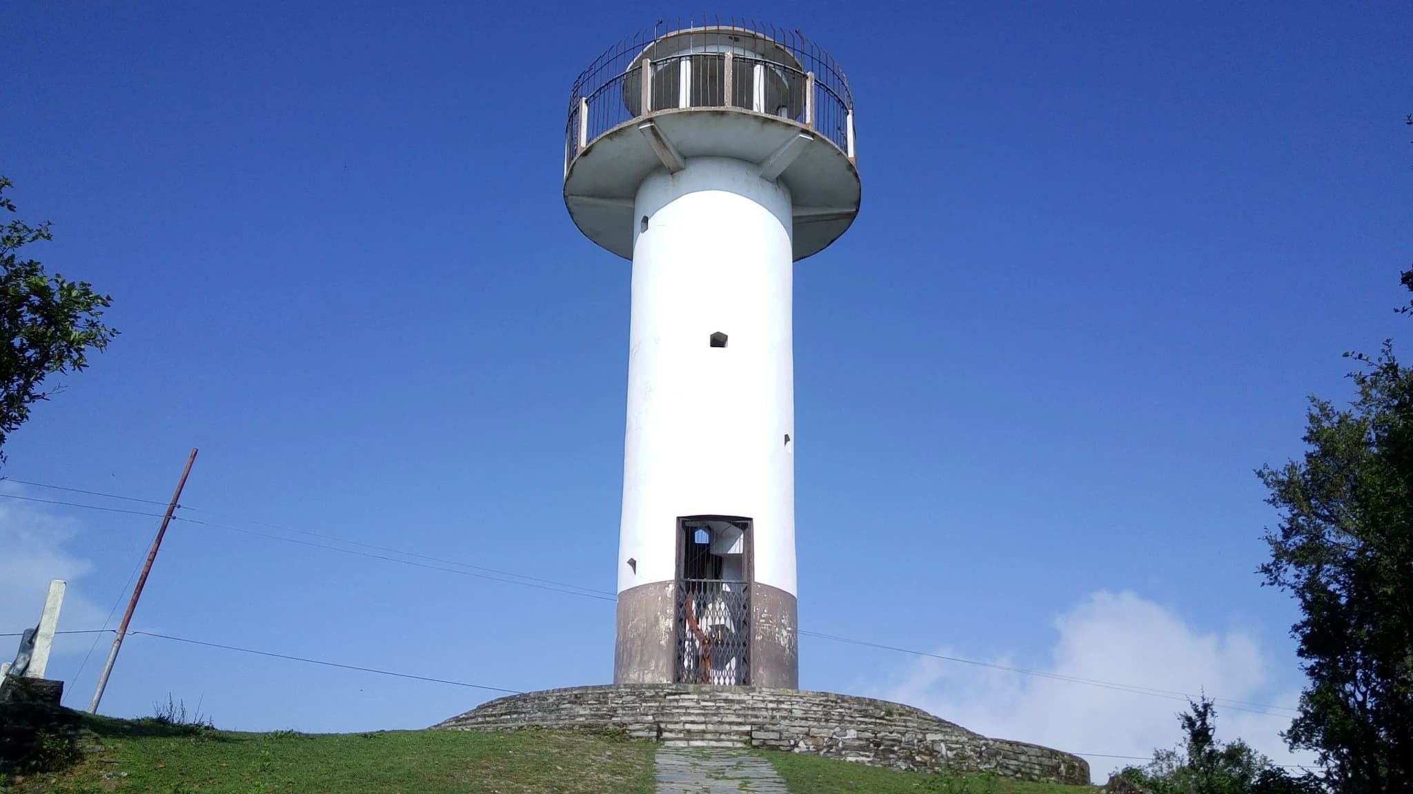
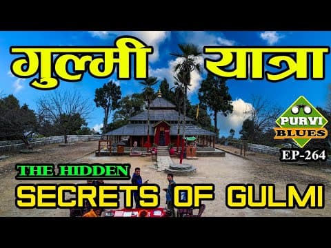
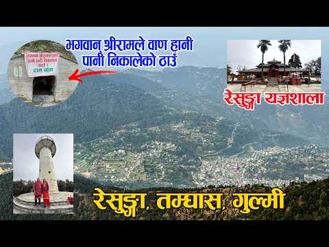
Resunga Hill and Sacred Forest (रेसुङ्गा डाँडा तथा तपोभूमि / रेसुङ्गा संरक्षित वन), soaring to an elevation of 2,347 meters above the district headquarters of Tamghas in Resunga Municipality Wards 8 and 9, is the supreme spiritual sanctuary and crowning natural landmark of Gulmi District. According to profound Vedic and Puranic lore, this mist-shrouded mountain was the ancient hermitage of the venerated sage Rishyasringa (ऋष्यशृङ्ग मुनि), whose austere penance brought rain to the drought-stricken kingdom of Ayodhya and who later conducted the Putrakameshti Yagya for King Dasharatha in the Ramayana epic. In the late 19th and early 20th centuries, the sacred ascetic tradition was revived by the saintly hermit Yadukananda Swami (Shashidhar Swami), who established the perpetual Yagyashala sacrificial pavilion where the sacred Vedic fire has burned continuously for over a century. The complex encompasses a network of revered shrines including the Siddha Baba Temple, Shiva Mandir, Radha Krishna Temple, the holy Bishnu Pokhari pond, and ascetic meditation caves scattered among ancient oak, rhododendron, and deodar forests. Crowning the highest ridge is a grand multi-story view tower that commands breathtaking 360-degree panoramas across western and central Nepal, sweeping from the Dhaulagiri and Annapurna massifs to Machhapuchhre and the Mahabharat hills. Annually during the holy month of Shrawan and on Harisayani Ekadashi, thousands of Hindu pilgrims and nature enthusiasts ascend through scenic forest walking trails to offer worship, bathe in sacred waters, and experience the pristine mountain tranquility.
Resunga Hill and Sacred Forest (रेसुङ्गा डाँडा तथा तपोभूमि / रेसुङ्गा संरक्षित वन), soaring to an elevation of 2,347 meters above the district headquarters of Tamghas in Resunga Municipality Wards 8 and 9, is the supreme spiritual sanctuary and crowning natural landmark of Gulmi District. According to profound Vedic and Puranic lore, this mist-shrouded mountain was the ancient hermitage of the venerated sage Rishyasringa (ऋष्यशृङ्ग मुनि), whose austere penance brought rain to the drought-stricken kingdom of Ayodhya and who later conducted the Putrakameshti Yagya for King Dasharatha in the Ramayana epic. In the late 19th and early 20th centuries, the sacred ascetic tradition was revived by the saintly hermit Yadukananda Swami (Shashidhar Swami), who established the perpetual Yagyashala sacrificial pavilion where the sacred Vedic fire has burned continuously for over a century. The complex encompasses a network of revered shrines including the Siddha Baba Temple, Shiva Mandir, Radha Krishna Temple, the holy Bishnu Pokhari pond, and ascetic meditation caves scattered among ancient oak, rhododendron, and deodar forests. Crowning the highest ridge is a grand multi-story view tower that commands breathtaking 360-degree panoramas across western and central Nepal, sweeping from the Dhaulagiri and Annapurna massifs to Machhapuchhre and the Mahabharat hills. Annually during the holy month of Shrawan and on Harisayani Ekadashi, thousands of Hindu pilgrims and nature enthusiasts ascend through scenic forest walking trails to offer worship, bathe in sacred waters, and experience the pristine mountain tranquility.
2 available
2 available
YouTube
Open YouTube
YouTube
Open YouTube
Discover More

Dhurkot Durbar and Kot (धुर्कोट दरबार तथा ऐतिहासिक कोट), dramatically commanding the highest hilltop ridge of Dhurkot Rural Municipality Wards 3 and 4 at an elevation of 1,520 meters, is the historic royal citadel and military fortress of the ancient Dhurkot Principality—one of the renowned Chaubisi Rajya kingdoms that ruled the western hills before the unification of Nepal. Strategically positioned atop a 360-degree vantage point overlooking the surrounding terraced valleys, mountain passes, and the distant snowy crests of the Dhaulagiri massif, Dhurkot Durbar served as an impregnable bastion of statecraft, defense, and martial ritual. The fortress complex preserves ancient stone ramparts, stone-paved battlements, historical watchtowers, and the historic royal armory (Kot Ghar) housing antique cannons, matchlock rifles, and ancestral curved Khukuris dating back centuries. At the spiritual core of the fortress stands the sacred Kot Bhagwati Temple, dedicated to the guardian warrior goddess. During Chaite Dashain and Bada Dashain, the citadel transforms into a jubilant center of traditional martial fanfare, sword processions (Khadga Jatra), traditional Panchai Baja musical performances, and ceremonial animal offerings honoring regional heritage. The site stands as a proud testament to Gulmi's medieval sovereignty, martial valor, and enduring mid-hill architecture.

Vichitra Cave (विचित्र गुफा, धुर्कोट), nestled on the forested karst limestone slopes of Dhurkot Rural Municipality Ward 5 (Bastun) at an elevation of 1,350 meters, is Gulmi District's most celebrated subterranean geological wonder. Accidentally discovered in 1988 (2045 BS) by local forest gatherers, the name 'Vichitra' translates directly to 'Bizarre' or 'Extraordinary'—a tribute to the astonishing array of natural speleothems sculpting its interior. The cave penetrates over 185 meters deep into the mountain, dividing into multiple cavernous chambers, subterranean tunnels, and towering natural stone galleries formed over hundreds of thousands of years through slow water dissolution of limestone. Inside, visitors are awed by countless intricate stalactites and stalagmites resembling sacred Hindu motifs, including Shiva Lingams, Lord Ganesh, the wish-fulfilling divine cow Kamadhenu, sheshnag serpent coils, and natural stone bells that resonate with musical tones when gently struck. The cave maintains a perennial cool microclimate with crystal-clear subterranean dripping water droplets creating natural reflection pools. Now equipped with safe interior handrails, stone steps, and solar illumination managed by the local conservation committee, Vichitra Cave attracts spelunkers, geological researchers, and spiritual devotees from across western Nepal.

Known as Ama Yangri Peak, and also called Ama Yangri or Ama Yangri Danda, this spectacular Himalayan viewpoint in the Helambu region of Sindhupalchok district is one of Nepal's finest short trekking destinations. Rising to an elevation of approximately 3,771 meters, the peak is revered by the local Hyolmo (Yolmo) community, who consider it a sacred mountain blessed by a protective mother deity, from which the name "Ama" (Mother) is derived. The trek to the summit passes through enchanting rhododendron and pine forests, colorful prayer flags, traditional monasteries, and peaceful Hyolmo villages, offering a perfect blend of natural beauty and cultural heritage. From the summit, visitors are rewarded with breathtaking 360-degree panoramic views of the Langtang, Jugal Himal, Dorje Lakpa, Ganesh Himal, Gaurishankar, and even Mount Everest on exceptionally clear days. The peak is especially famous for its mesmerizing sunrise, when the first rays of light illuminate the snow-capped Himalayas in brilliant shades of gold and orange. Spring and autumn provide the best trekking conditions, with blooming rhododendrons, pleasant weather, and crystal-clear mountain vistas. Whether you're seeking a rewarding Himalayan hike, spectacular photography, or a peaceful spiritual escape, Ama Yangri Peak (Ama Yangri/Ama Yangri Danda) offers one of the most unforgettable viewpoints in central Nepal.

Australian Camp, historically known as Thula Kharka (Great Pasture), is a renowned scenic ridge viewpoint and serene trekking settlement situated at an elevation of 2,060 metres in Kaski. Located along the ridge above Kande village and Dhampus, the site gained its popular name in the 1990s when Austrian (and later Australian) expeditioners utilized the expansive meadow as a peaceful base. The camp offers an unobstructed 360-degree panorama of the central Himalayas, providing close-up perspectives of Annapurna South, Hiunchuli, Machhapuchhre, and Lamjung Himal rising dramatically above the Modi Khola valley. The sunrise and sunset from the camp's grassy ridge crest are legendary, illuminating snow giants against alpine skies. Accessible via an easy 1.5 to 2-hour uphill hike through rhododendron and oak forests from Kande highway, Australian Camp serves as an ideal introductory day-hike, family trek, or launching point for the Mardi Himal and Dhampus circuit trails. Well-appointed lodges and camping grounds provide comfortable mountain hospitality.

The Badagaun-Kaiyan Suspension Bridge (frequently referred to as the Kushma-Mudikuwa Bridge or Kaiya Suspension Bridge), spanning between Badagaun in Kusma Municipality and Kaiyan/Mudikuwa on the southern canyon plateau, is among the highest pedestrian suspension footbridges in Nepal and all of South Asia. Completed in 2013 AD (2070 BS) across the deepest section of the Modi Khola gorge, the footbridge measures 359 metres (1,178 feet) in length and hangs suspended at a staggering elevation of 156 metres (512 feet) above the river. The bridge was engineered as part of a visionary initiative to overcome the severe topographic isolation of southern Parbat's agricultural communities. Its soaring height easily surpasses ordinary suspension bridges, creating an imposing silhouette that seems almost gossamer-thin against the vast canyon landscape. Crossing the bridge gives visitors the sensation of walking through open air, accompanied by the distant roar of the Modi River echoing off vertical limestone rock faces far below. Along with its sister crossing at Gyadi and the Kali Gandaki bridge to Baglung, the Badagaun-Kaiyan bridge forms part of the renowned 'Bridge Circuit' of Kushma. Travelers often undertake a loop walk connecting all three mega-bridges in a single afternoon, experiencing three distinct canyon perspectives, panoramic mountain vistas, and the unique cultural life of the cliff-top settlements flanking the district headquarters.

The Baglung-Parbat Suspension Bridge (officially named the Gandaki Golden Bridge or Gandaki Sunaulo Jhula), spanning the dramatic Kali Gandaki River canyon between Bangechaur in Baglung Municipality Ward 1 and Aduwabari in Kusma Municipality Ward 1 of Parbat District, is an engineering marvel and one of the longest single-span pedestrian suspension footbridges in the world. Completed in July 2020 at a total length of 567 metres (1,860 feet), the bridge hangs suspended at a breathtaking height of 122 metres above the roaring waters of the Kali Gandaki River. The bridge was engineered to provide direct pedestrian and light transport connectivity between Baglung Bazaar and Kusma, reducing a arduous two-hour trek down the river canyon to an exhilarating ten-minute stroll across the abyss. Built with state-of-the-art steel cable suspension technology and equipped with anti-sway wind anchors and safety mesh, the bridge has rapidly transformed into a premier national landmark and sightseeing attraction. Walking across the expanse of the Gandaki Golden Bridge offers visitors a thrilling perspective of one of the deepest river gorges in the world. Looking northward, pedestrians can gaze up the Kali Gandaki canyon toward the towering snowy summit of Dhaulagiri I (8,167 m), while looking down reveals the turquoise river rapids rushing past terraced cliff faces. The bridge is illuminated in the evenings, drawing photographers, tourists, and locals enjoying twilight promenades.