YouTube
Open YouTube
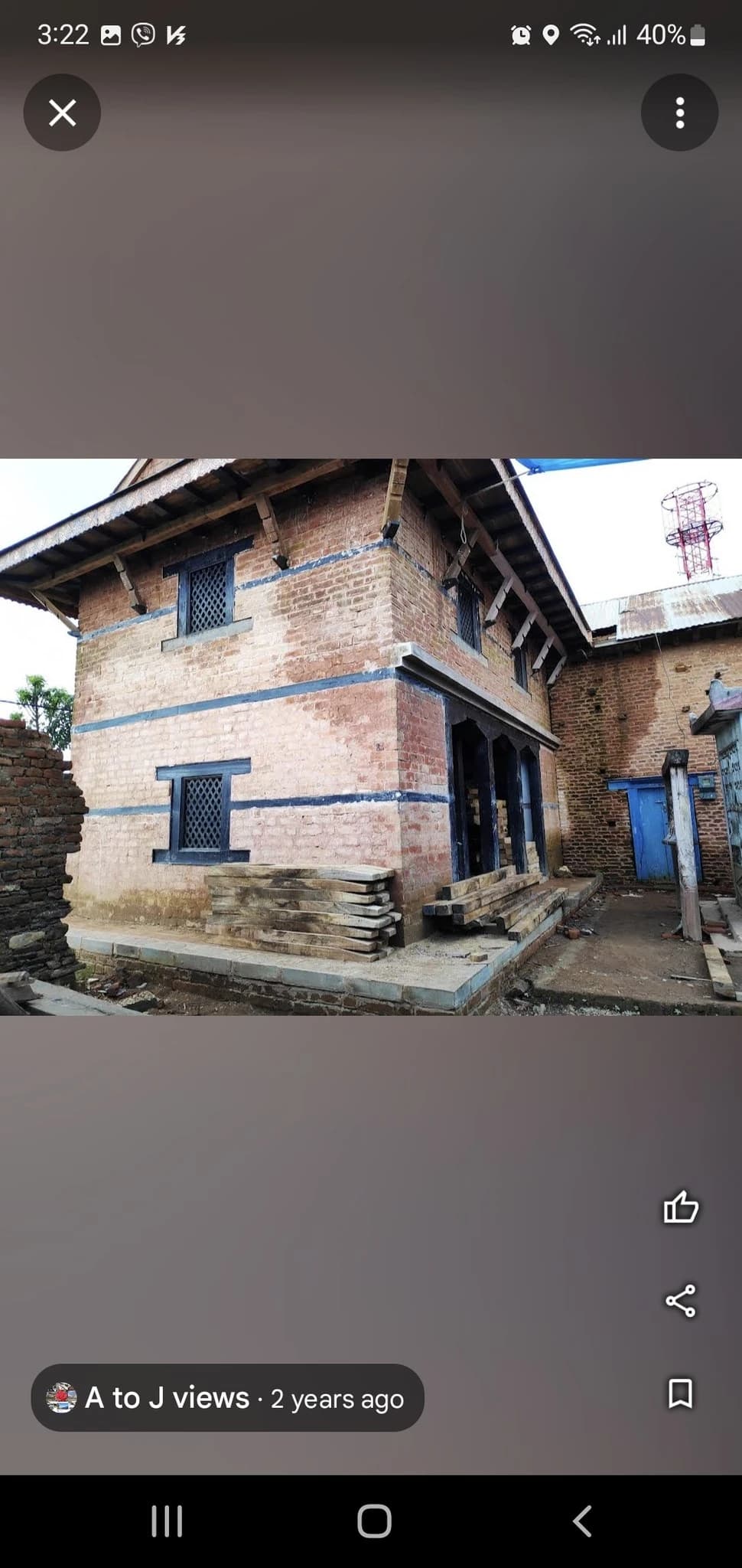
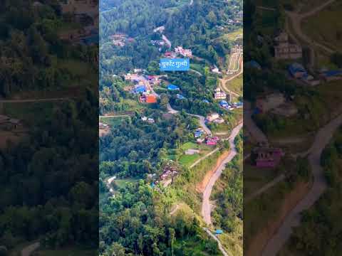
Dhurkot Durbar and Kot (धुर्कोट दरबार तथा ऐतिहासिक कोट), dramatically commanding the highest hilltop ridge of Dhurkot Rural Municipality Wards 3 and 4 at an elevation of 1,520 meters, is the historic royal citadel and military fortress of the ancient Dhurkot Principality—one of the renowned Chaubisi Rajya kingdoms that ruled the western hills before the unification of Nepal. Strategically positioned atop a 360-degree vantage point overlooking the surrounding terraced valleys, mountain passes, and the distant snowy crests of the Dhaulagiri massif, Dhurkot Durbar served as an impregnable bastion of statecraft, defense, and martial ritual. The fortress complex preserves ancient stone ramparts, stone-paved battlements, historical watchtowers, and the historic royal armory (Kot Ghar) housing antique cannons, matchlock rifles, and ancestral curved Khukuris dating back centuries. At the spiritual core of the fortress stands the sacred Kot Bhagwati Temple, dedicated to the guardian warrior goddess. During Chaite Dashain and Bada Dashain, the citadel transforms into a jubilant center of traditional martial fanfare, sword processions (Khadga Jatra), traditional Panchai Baja musical performances, and ceremonial animal offerings honoring regional heritage. The site stands as a proud testament to Gulmi's medieval sovereignty, martial valor, and enduring mid-hill architecture.
Dhurkot Durbar and Kot (धुर्कोट दरबार तथा ऐतिहासिक कोट), dramatically commanding the highest hilltop ridge of Dhurkot Rural Municipality Wards 3 and 4 at an elevation of 1,520 meters, is the historic royal citadel and military fortress of the ancient Dhurkot Principality—one of the renowned Chaubisi Rajya kingdoms that ruled the western hills before the unification of Nepal. Strategically positioned atop a 360-degree vantage point overlooking the surrounding terraced valleys, mountain passes, and the distant snowy crests of the Dhaulagiri massif, Dhurkot Durbar served as an impregnable bastion of statecraft, defense, and martial ritual. The fortress complex preserves ancient stone ramparts, stone-paved battlements, historical watchtowers, and the historic royal armory (Kot Ghar) housing antique cannons, matchlock rifles, and ancestral curved Khukuris dating back centuries. At the spiritual core of the fortress stands the sacred Kot Bhagwati Temple, dedicated to the guardian warrior goddess. During Chaite Dashain and Bada Dashain, the citadel transforms into a jubilant center of traditional martial fanfare, sword processions (Khadga Jatra), traditional Panchai Baja musical performances, and ceremonial animal offerings honoring regional heritage. The site stands as a proud testament to Gulmi's medieval sovereignty, martial valor, and enduring mid-hill architecture.
1 available
1 available
YouTube
Open YouTube
Discover More

Resunga Hill and Sacred Forest (रेसुङ्गा डाँडा तथा तपोभूमि / रेसुङ्गा संरक्षित वन), soaring to an elevation of 2,347 meters above the district headquarters of Tamghas in Resunga Municipality Wards 8 and 9, is the supreme spiritual sanctuary and crowning natural landmark of Gulmi District. According to profound Vedic and Puranic lore, this mist-shrouded mountain was the ancient hermitage of the venerated sage Rishyasringa (ऋष्यशृङ्ग मुनि), whose austere penance brought rain to the drought-stricken kingdom of Ayodhya and who later conducted the Putrakameshti Yagya for King Dasharatha in the Ramayana epic. In the late 19th and early 20th centuries, the sacred ascetic tradition was revived by the saintly hermit Yadukananda Swami (Shashidhar Swami), who established the perpetual Yagyashala sacrificial pavilion where the sacred Vedic fire has burned continuously for over a century. The complex encompasses a network of revered shrines including the Siddha Baba Temple, Shiva Mandir, Radha Krishna Temple, the holy Bishnu Pokhari pond, and ascetic meditation caves scattered among ancient oak, rhododendron, and deodar forests. Crowning the highest ridge is a grand multi-story view tower that commands breathtaking 360-degree panoramas across western and central Nepal, sweeping from the Dhaulagiri and Annapurna massifs to Machhapuchhre and the Mahabharat hills. Annually during the holy month of Shrawan and on Harisayani Ekadashi, thousands of Hindu pilgrims and nature enthusiasts ascend through scenic forest walking trails to offer worship, bathe in sacred waters, and experience the pristine mountain tranquility.

Vichitra Cave (विचित्र गुफा, धुर्कोट), nestled on the forested karst limestone slopes of Dhurkot Rural Municipality Ward 5 (Bastun) at an elevation of 1,350 meters, is Gulmi District's most celebrated subterranean geological wonder. Accidentally discovered in 1988 (2045 BS) by local forest gatherers, the name 'Vichitra' translates directly to 'Bizarre' or 'Extraordinary'—a tribute to the astonishing array of natural speleothems sculpting its interior. The cave penetrates over 185 meters deep into the mountain, dividing into multiple cavernous chambers, subterranean tunnels, and towering natural stone galleries formed over hundreds of thousands of years through slow water dissolution of limestone. Inside, visitors are awed by countless intricate stalactites and stalagmites resembling sacred Hindu motifs, including Shiva Lingams, Lord Ganesh, the wish-fulfilling divine cow Kamadhenu, sheshnag serpent coils, and natural stone bells that resonate with musical tones when gently struck. The cave maintains a perennial cool microclimate with crystal-clear subterranean dripping water droplets creating natural reflection pools. Now equipped with safe interior handrails, stone steps, and solar illumination managed by the local conservation committee, Vichitra Cave attracts spelunkers, geological researchers, and spiritual devotees from across western Nepal.

Ajayamerukot is a monumental medieval archaeological citadel and palace complex established in the 13th to 14th century CE as the royal winter capital of the Katyuri and Doti Rainka Kings. Perched defensively atop an isolated mountain spur in Ward 2 of Ajaymeru Rural Municipality at an altitude of 1,313 metres, the site is bordered on three sides by sheer ravines carved by the Chamdola and Baunera streams. The extensive archaeological precinct preserves the foundation platforms of a multi-tiered stone royal palace, expansive paved courtyards, an assembly hall (Baithak), carved Shikhara-style stone dewals, and defensive ramparts. An exceptional architectural marvel of the site is the subterranean Rani Naula (रानी नाउला), an intricately dressed stone step-well featuring arched corridors and classical Katyuri decorative friezes. Recognized as an official Department of Archaeology monument under ID NP-DD-04 and nominated on Nepal's UNESCO World Heritage Tentative List, Ajayamerukot stands as one of the most significant medieval monarchical complexes in the Himalayas.

Alapeshwar Cave (locally known as Alpeswor Gupha or Alapu Cave), nestled within the forested hills of Kusma Municipality Ward 7 near Gyadichaur and the Silmi forest corridor, is an extraordinary natural speleological cave network in Parbat District. Discovered in recent decades by local community members, the cave extends several hundred metres into subterranean limestone bedrock, offering an intriguing subterranean exploration destination for eco-tourists and adventure travelers. The interior of Alapeshwar Cave features multiple natural limestone chambers linked by winding rock corridors. Over tens of thousands of years, mineral-rich seepage water has sculpted spectacular calcite formations, including delicate stalactites hanging from cavern ceilings, massive stalagmites rising from the floor, flowstone curtains, and crystalline rock terraces. In several chambers, clear subterranean spring water flows over the smooth limestone floor, creating natural underground wading pools and tranquil echo chambers. Local development committees have installed solar-powered illumination along the main walking galleries, safe metal ladders, and protective handrails to facilitate visitor access without disturbing the delicate cave ecology and resident microbat colonies. Unlike heavily visited commercial caves, Alapeshwar retains a raw, uncommercialized subterranean ambiance that rewards curious travelers exploring the diverse canyon landscape of Kushma.

Amargadhi Fort is a monumental late 18th-century stone military fortification perched at an elevation of 1,901 metres along the crest of the Mahabharat range in Khalanga, Dadeldhura. Constructed in 1790 CE (1847 BS) by Gorkhali Commander Bada Kaji Amar Singh Thapa following the unification of the Far-Western hill principalities, the citadel commanded vital strategic mountain trade and troop routes between Doti, Kumaon, and the Mahakali basin. Enclosed by massive stone bastion ramparts punctuated with defensive cannon embrasures, the inner fortress encompasses twenty-two subterranean vaulted chambers that served as troop barracks and munitions depots, a central Kotghar armory, and a shrine dedicated to Ugra Bhairav. Cataloged under Department of Archaeology monument identification NP-DD-08, the citadel offers sweeping panoramic vistas across the terraced valleys and surrounding pine-clad ridges.

Argha Bhagwati Temple and Durbar (अर्घा भगवती मन्दिर तथा ऐतिहासिक अर्घा दरबार), majestically crowning the prominent Arghakot hilltop ridge at an elevation of 1,720 meters in Sandhikharka Municipality Ward 9, is the historic royal citadel and military fortress of the ancient Argha Kingdom—one of the influential Chaubisi principalities from which Arghakhanchi District derives half of its name. Established during the medieval period prior to Nepal's territorial unification, Argha Durbar functioned as an impregnable hill garrison commanding panoramic surveillance over the surrounding valleys. The site contains historic stone fortifications, the royal armory (Kot Ghar) preserving antique weapons, curved Khukuris, battle axes, and ceremonial bronze cannons from the 16th to 18th centuries, and the revered temple dedicated to Goddess Argha Bhagwati. The temple is renowned across western Nepal for its vibrant, centuries-old Dashain celebrations, particularly during Maha Navami and Vijaya Dashami, when traditional sword dances (Khadga Jatra), sacred animal sacrifices, and state military drum processions are conducted in accordance with ancient royal decrees. From the fort ramparts, visitors enjoy commanding vistas stretching across the verdant Sandhikharka river valley to the south and the snowy peaks of Dhaulagiri and Annapurna to the north.