YouTube
Triveni Patan & Badimalika Landscape
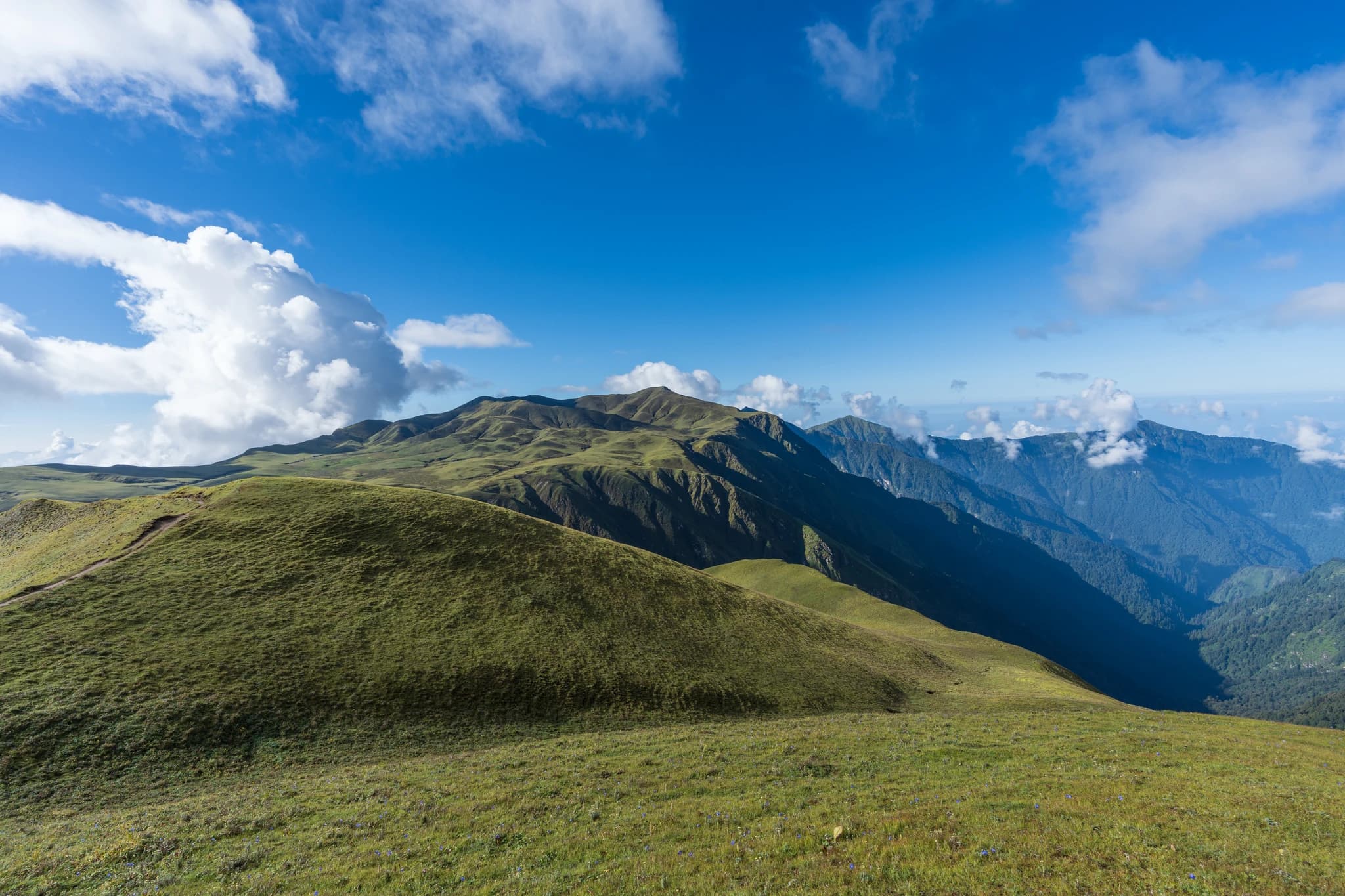
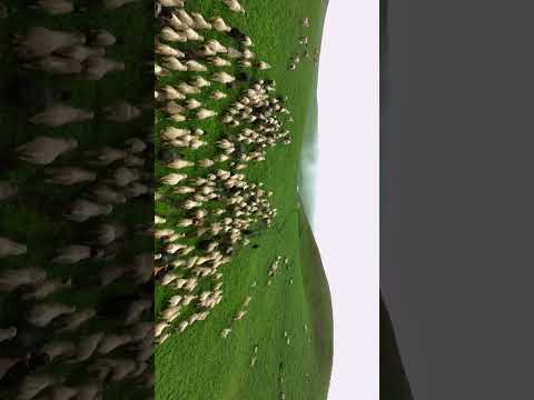
Triveni Patan (त्रिवेणी पाटन) is a breathtaking high-altitude grassland plateau and sacred river confluence nestled at an elevation of approximately 3,840 metres in upper Triveni Municipality, Bajura District. Widely celebrated as one of the most magnificent sub-alpine landscapes in the Himalayas, Triveni forms the ecological and cultural heart of the legendary '22 Patans'—a sweeping expanse of rolling velvet-green pastures, pristine tarns, and gentle knolls situated above the natural tree line. At the center of the plateau lies Triveni Dham, the sacred confluence where three alpine glacial rivulets meet. In Hindu tradition, this confluence is revered as a spiritual equal to the sacred Prayag Triveni, representing the invisible confluence of the holy rivers Ganga, Jamuna, and Saraswati. Pilgrims undertaking the Badimalika yatra establish basecamp here, taking ritual cleansing baths in the ice-cold waters and performing solemn ancestor remembrance rites (Pinda Daan) before ascending the final rocky crest to the goddess's summit shrine. During the summer monsoon and early autumn (July to September), the meadows burst into an extraordinary tapestry of wild alpine flora, including yellow and blue primulas, potentillas, saxifrages, and rare medicinal herbs such as Yarsagumba (Cordyceps), Panchaule, and Katuki. Nomadic pastoralists graze vast herds of mountain sheep, horses, and crossbred chauri cattle across the open pastures. Outside of the annual festival period, Triveni Patan transforms into a tranquil, untouched wilderness offering stellar opportunities for high-altitude trekking, astrophotography, and panoramic vistas of the snow-clad Api-Saipal range.
Triveni Patan (त्रिवेणी पाटन) is a breathtaking high-altitude grassland plateau and sacred river confluence nestled at an elevation of approximately 3,840 metres in upper Triveni Municipality, Bajura District. Widely celebrated as one of the most magnificent sub-alpine landscapes in the Himalayas, Triveni forms the ecological and cultural heart of the legendary '22 Patans'—a sweeping expanse of rolling velvet-green pastures, pristine tarns, and gentle knolls situated above the natural tree line. At the center of the plateau lies Triveni Dham, the sacred confluence where three alpine glacial rivulets meet. In Hindu tradition, this confluence is revered as a spiritual equal to the sacred Prayag Triveni, representing the invisible confluence of the holy rivers Ganga, Jamuna, and Saraswati. Pilgrims undertaking the Badimalika yatra establish basecamp here, taking ritual cleansing baths in the ice-cold waters and performing solemn ancestor remembrance rites (Pinda Daan) before ascending the final rocky crest to the goddess's summit shrine. During the summer monsoon and early autumn (July to September), the meadows burst into an extraordinary tapestry of wild alpine flora, including yellow and blue primulas, potentillas, saxifrages, and rare medicinal herbs such as Yarsagumba (Cordyceps), Panchaule, and Katuki. Nomadic pastoralists graze vast herds of mountain sheep, horses, and crossbred chauri cattle across the open pastures. Outside of the annual festival period, Triveni Patan transforms into a tranquil, untouched wilderness offering stellar opportunities for high-altitude trekking, astrophotography, and panoramic vistas of the snow-clad Api-Saipal range.
4 available
1 available
YouTube
Triveni Patan & Badimalika Landscape
Discover More

Badimalika Temple (बडीमालिका मन्दिर) is the supreme Hindu Shaktipeeth and spiritual summit of Far-Western Nepal, situated on an isolated mountain crag at an elevation of 4,214 metres on the border of Bajura and Kalikot districts. According to classical Hindu mythology, following the self-immolation of Sati Devi at Daksha Prajapati's sacrificial fire, Lord Shiva wandered across the universe carrying her body; her left shoulder (Baahu) is believed to have fallen on this high Himalayan ridge, sanctifying the peak as the eldest ('Jethi') Shakti shrine of the region. The temple hosts one of Nepal's most revered annual pilgrimages during Janai Purnima (Bhadra Shukla Chaturdashi), drawing tens of thousands of devotees, ascetics, and shamans (Dhamis) from across Karnali, Sudurpashchim, and northern India. A ceremonial state procession (Sarkari Doli) bearing official silver parasols (chhatra) and traditional musical instruments ascends from Doti, Jumla, Kalikot, and Martadi to perform ancient state-sponsored rituals at the summit shrine. The journey to Badimalika is a demanding wilderness trek requiring three to five days of self-sufficient foot travel across steep ridge trails, through dwarf rhododendron copses, and over vast alpine grazing meadows. From the stone temple platform adorned with thousands of consecrated brass bells and iron tridents (trishuls), visitors are treated to an uninterrupted 360-degree panorama of Mount Saipal, Mount Api, the Kanjirowa massif, and the rolling green carpets of the surrounding 22 Patans. Because no permanent settlement exists above 3,000 metres, pilgrims camp in tented settlements or temporary stone shelters, braving thin air, sudden mountain squalls, and chilly alpine nights.

Nateshwari Temple (नाटेश्वरी मन्दिर), also known locally as Natyashwori or Nachanthali, is a distinguished Hindu pilgrimage temple located at Lamagaun in Triveni Municipality-7, Bajura District. Perched at an elevation of 2,068 metres amidst terraced mid-hill valleys, the temple is dedicated to Goddess Bhagawati and serves as the vital architectural and ritual sister sanctuary to the high-altitude Badimalika Temple. According to local spiritual tradition, Goddess Nateshwari is revered as the elder sister ('Didi') of Goddess Badimalika. Mythological lore recounts that Lord Shiva and Goddess Parvati performed divine cosmic dances upon this open natural amphitheatre, giving the sacred site its ancient name 'Nachanthali' (dancing theatre), which later evolved into Nateshwari. Pilgrims returning from the strenuous high-altitude pilgrimage to Badimalika consider their religious vows incomplete until they pay homage at Nateshwari Temple to offer thanksgiving for safe passage. The temple complex features classical multi-tiered pagoda architecture rebuilt with intricately hand-carved deodar wood columns, traditional stone masonry, and ornate copper roof trimmings. A rare dual priesthood system governs the sanctuary: Shahi Thakuri priests conduct the inner sanctum rituals while Joshi Brahmin priests perform formal Vedic ceremonies. Major religious gatherings take place during Chaite Dashain, Bada Dashain, and the Janai Purnima festival, accompanied by spirited community Deuda circle songs, traditional Hudke drumming, and festive village feasts.

Known as Ama Yangri Peak, and also called Ama Yangri or Ama Yangri Danda, this spectacular Himalayan viewpoint in the Helambu region of Sindhupalchok district is one of Nepal's finest short trekking destinations. Rising to an elevation of approximately 3,771 meters, the peak is revered by the local Hyolmo (Yolmo) community, who consider it a sacred mountain blessed by a protective mother deity, from which the name "Ama" (Mother) is derived. The trek to the summit passes through enchanting rhododendron and pine forests, colorful prayer flags, traditional monasteries, and peaceful Hyolmo villages, offering a perfect blend of natural beauty and cultural heritage. From the summit, visitors are rewarded with breathtaking 360-degree panoramic views of the Langtang, Jugal Himal, Dorje Lakpa, Ganesh Himal, Gaurishankar, and even Mount Everest on exceptionally clear days. The peak is especially famous for its mesmerizing sunrise, when the first rays of light illuminate the snow-capped Himalayas in brilliant shades of gold and orange. Spring and autumn provide the best trekking conditions, with blooming rhododendrons, pleasant weather, and crystal-clear mountain vistas. Whether you're seeking a rewarding Himalayan hike, spectacular photography, or a peaceful spiritual escape, Ama Yangri Peak (Ama Yangri/Ama Yangri Danda) offers one of the most unforgettable viewpoints in central Nepal.

Australian Camp, historically known as Thula Kharka (Great Pasture), is a renowned scenic ridge viewpoint and serene trekking settlement situated at an elevation of 2,060 metres in Kaski. Located along the ridge above Kande village and Dhampus, the site gained its popular name in the 1990s when Austrian (and later Australian) expeditioners utilized the expansive meadow as a peaceful base. The camp offers an unobstructed 360-degree panorama of the central Himalayas, providing close-up perspectives of Annapurna South, Hiunchuli, Machhapuchhre, and Lamjung Himal rising dramatically above the Modi Khola valley. The sunrise and sunset from the camp's grassy ridge crest are legendary, illuminating snow giants against alpine skies. Accessible via an easy 1.5 to 2-hour uphill hike through rhododendron and oak forests from Kande highway, Australian Camp serves as an ideal introductory day-hike, family trek, or launching point for the Mardi Himal and Dhampus circuit trails. Well-appointed lodges and camping grounds provide comfortable mountain hospitality.

The Badagaun-Kaiyan Suspension Bridge (frequently referred to as the Kushma-Mudikuwa Bridge or Kaiya Suspension Bridge), spanning between Badagaun in Kusma Municipality and Kaiyan/Mudikuwa on the southern canyon plateau, is among the highest pedestrian suspension footbridges in Nepal and all of South Asia. Completed in 2013 AD (2070 BS) across the deepest section of the Modi Khola gorge, the footbridge measures 359 metres (1,178 feet) in length and hangs suspended at a staggering elevation of 156 metres (512 feet) above the river. The bridge was engineered as part of a visionary initiative to overcome the severe topographic isolation of southern Parbat's agricultural communities. Its soaring height easily surpasses ordinary suspension bridges, creating an imposing silhouette that seems almost gossamer-thin against the vast canyon landscape. Crossing the bridge gives visitors the sensation of walking through open air, accompanied by the distant roar of the Modi River echoing off vertical limestone rock faces far below. Along with its sister crossing at Gyadi and the Kali Gandaki bridge to Baglung, the Badagaun-Kaiyan bridge forms part of the renowned 'Bridge Circuit' of Kushma. Travelers often undertake a loop walk connecting all three mega-bridges in a single afternoon, experiencing three distinct canyon perspectives, panoramic mountain vistas, and the unique cultural life of the cliff-top settlements flanking the district headquarters.

The Baglung-Parbat Suspension Bridge (officially named the Gandaki Golden Bridge or Gandaki Sunaulo Jhula), spanning the dramatic Kali Gandaki River canyon between Bangechaur in Baglung Municipality Ward 1 and Aduwabari in Kusma Municipality Ward 1 of Parbat District, is an engineering marvel and one of the longest single-span pedestrian suspension footbridges in the world. Completed in July 2020 at a total length of 567 metres (1,860 feet), the bridge hangs suspended at a breathtaking height of 122 metres above the roaring waters of the Kali Gandaki River. The bridge was engineered to provide direct pedestrian and light transport connectivity between Baglung Bazaar and Kusma, reducing a arduous two-hour trek down the river canyon to an exhilarating ten-minute stroll across the abyss. Built with state-of-the-art steel cable suspension technology and equipped with anti-sway wind anchors and safety mesh, the bridge has rapidly transformed into a premier national landmark and sightseeing attraction. Walking across the expanse of the Gandaki Golden Bridge offers visitors a thrilling perspective of one of the deepest river gorges in the world. Looking northward, pedestrians can gaze up the Kali Gandaki canyon toward the towering snowy summit of Dhaulagiri I (8,167 m), while looking down reveals the turquoise river rapids rushing past terraced cliff faces. The bridge is illuminated in the evenings, drawing photographers, tourists, and locals enjoying twilight promenades.