YouTube
Open YouTube
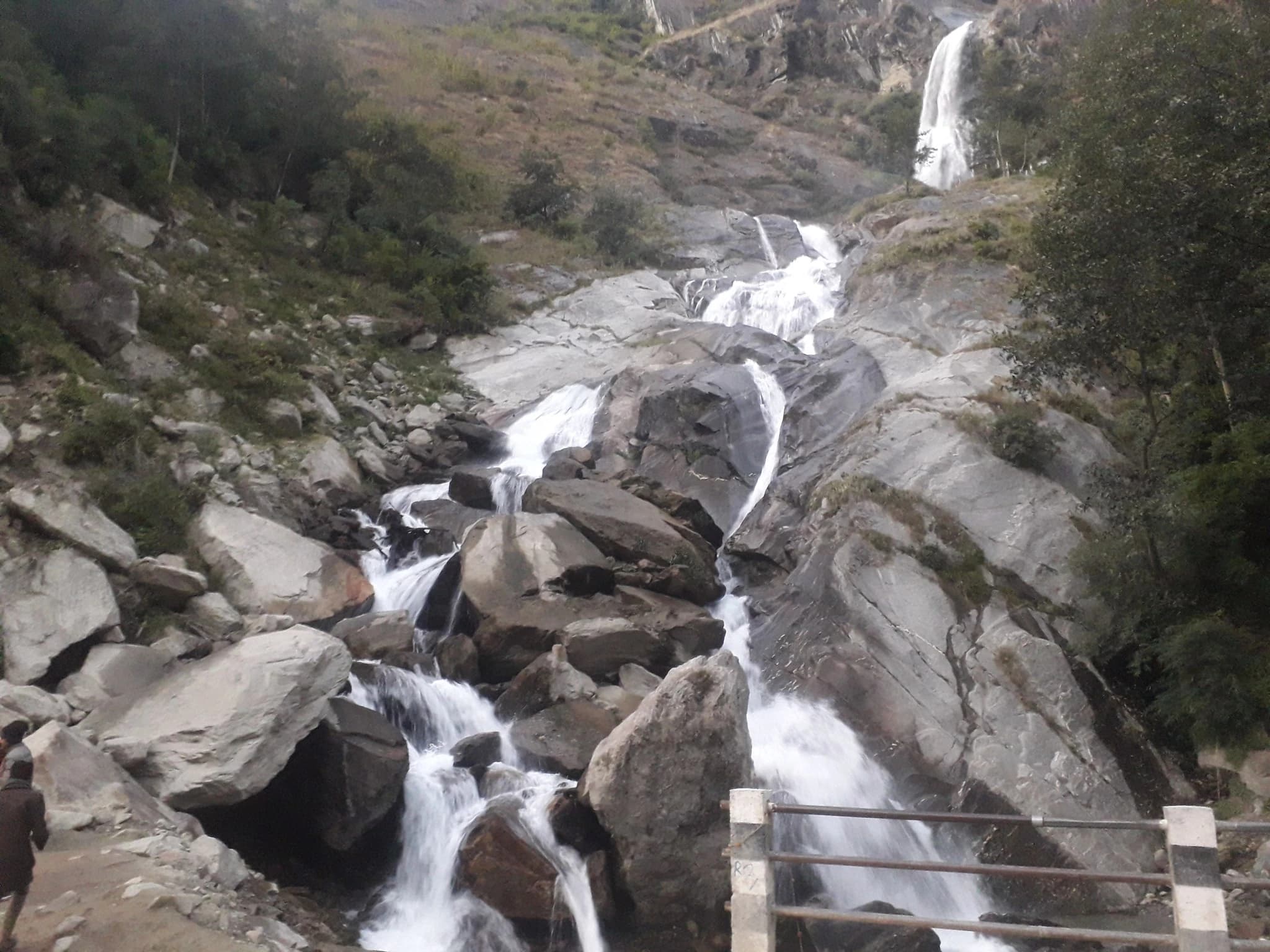
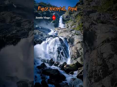
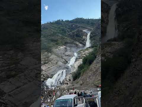
Rupse Waterfall (Rupse Chhahara), situated near Dana in Annapurna Rural Municipality of Myagdi District, is one of the most spectacular and dramatic waterfalls in Nepal. Originating from high alpine glacial streams beneath the northern Dhaulagiri icefall, the waterfall plunges precipitously over 300 metres (nearly 1,000 feet) down vertical granite cliffs into the rugged canyon below. The waterfall is located directly adjacent to the Beni-Jomsom-Muktinath highway, making it an iconic resting point and visual highlight for overland travelers and trekkers journeying toward Mustang. The cascading water thunders down in multiple dramatic tiers, producing perpetual clouds of cooling mist, vibrant rainbows in the afternoon sun, and polished rock formations carved by millennia of hydraulic force. Immediately north of Rupse Waterfall lies the deepest section of the Kali Gandaki River Gorge, where the river cuts between the 8,000-metre giants of Dhaulagiri and Annapurna. Visitors can view the waterfall safely from pedestrian bridges and observation platforms along the highway, with local stalls offering mountain refreshments.
Rupse Waterfall (Rupse Chhahara), situated near Dana in Annapurna Rural Municipality of Myagdi District, is one of the most spectacular and dramatic waterfalls in Nepal. Originating from high alpine glacial streams beneath the northern Dhaulagiri icefall, the waterfall plunges precipitously over 300 metres (nearly 1,000 feet) down vertical granite cliffs into the rugged canyon below. The waterfall is located directly adjacent to the Beni-Jomsom-Muktinath highway, making it an iconic resting point and visual highlight for overland travelers and trekkers journeying toward Mustang. The cascading water thunders down in multiple dramatic tiers, producing perpetual clouds of cooling mist, vibrant rainbows in the afternoon sun, and polished rock formations carved by millennia of hydraulic force. Immediately north of Rupse Waterfall lies the deepest section of the Kali Gandaki River Gorge, where the river cuts between the 8,000-metre giants of Dhaulagiri and Annapurna. Visitors can view the waterfall safely from pedestrian bridges and observation platforms along the highway, with local stalls offering mountain refreshments.
1 available
2 available
YouTube
Open YouTube
YouTube
Open YouTube
Discover More

Annapurna North Base Camp, situated at an elevation of 4,190 metres in Annapurna Rural Municipality of Myagdi District, is one of the most historically monumental mountaineering sites in the world. It is the authentic base camp from which the legendary 1950 French expedition, led by Maurice Herzog and Louis Lachenal, achieved the first-ever ascent of an 8,000-metre mountain (Annapurna I, 8,091 m) on June 3, 1950 -- three years before Mount Everest was summited. Following decades of obscurity while commercial trekking focused on the southern sanctuary in Kaski, the historic northern route from Narchyang village was meticulously rediscovered, cleared, and opened as the "Maurice Herzog Trail" through community-led conservation efforts. The trek winds through deep river gorges, ancient virgin birch and bamboo forests, and dramatic glacial moraines along the Mistri Khola. At the base camp cirque, trekkers stand in an awe-inspiring glacial amphitheatre directly beneath the formidable North Face and glaciated ridges of Annapurna I, Nilgiri North, and Tilicho Peak. The site features the turquoise alpine waters of Panchakunda Lake, holy natural caves, and a commemorative monument honoring the pioneering 1950 mountaineers. It offers an authentic, rugged wilderness experience for adventurous trekkers.

Beni Bazaar, situated at an altitude of 830 metres, is the vibrant administrative, commercial, and transport capital of Myagdi District. The town occupies a dramatic geographical setting at the confluence where the sacred Kali Gandaki River meets the crystal-clear waters of the Myagdi Khola, nestled in a deep valley bowl between surrounding green hills. Historically, Beni was an important trading crossroads for Trans-Himalayan salt caravans moving between Tibet, Mustang, and the southern plains of Nepal. Today, it serves as the essential gateway for overland expeditions heading north along the Kali Gandaki corridor toward Jomsom and Muktinath, as well as the western roadhead for treks entering the Dhaulagiri Circuit and Dhorpatan Hunting Reserve. Beni features lively market streets lined with traditional Newar and Magar merchants, handicraft shops, local restaurants serving authentic Thakali and Magar cuisine, and the sacred sangam (river confluence) where devout Hindus perform ritual ablutions. From the nearby vantage point of Lovely Hill, visitors can enjoy a panoramic bird's-eye view of the entire confluence town and the distant snowcaps of the Dhaulagiri range.

Dana, situated at approximately 1,440 metres in Annapurna Rural Municipality of northern Myagdi, is a historic settlement positioned at the southern threshold of the world-famous Kali Gandaki Gorge. For centuries, Dana functioned as a crucial customs outpost and overnight resting stage on the ancient salt-trade route connecting Tibet, Mustang, and the mid-hills of Nepal. The village is predominantly settled by the Thakali and Magar communities, celebrated for their immaculately clean paved slate streets, whitewashed double-story stone homes, and carved wooden balcony facades. Surrounded by steep terraced fields of maize, millet, and seasonal vegetables, Dana enjoys a pleasant transitional climate between the humid lower valleys and the arid heights of Mustang. Dana serves as the immediate staging base for visiting the thunderous Rupse Waterfall and the dramatic canyon of the Kali Gandaki. Traditional lodges in Dana offer authentic Thakali culinary hospitality, locally grown fruits, and fascinating insights into centuries of Trans-Himalayan commerce and heritage.

Galeshwor Dham, situated three kilometres north of Beni Bazaar on the western bank of the sacred Kali Gandaki River, is one of western Nepal's most revered Hindu pilgrimage sanctuaries. According to the sacred Hindu epic Swasthani Bratakatha, this holy Shakti Peetha marks the spot where the throat ("Gala") of goddess Sati Devi fell while Lord Shiva wandered across the universe carrying her mortal remains in cosmic mourning. The most extraordinary geological and architectural feature of Galeshwor is that the entire temple complex sits atop a single, colossal natural granite boulder covering an area of approximately nine ropanis (over 4,500 square meters). Remarkably, ancient pipal and banyan trees grow directly out of fissures in the solid rock without visible soil, and natural perennial water springs (kunds) emerge miraculously from the stone surface. The shrine features a central Shiva temple, an eternal sacred fire (Akhanda Dhuni) that has been kept burning continuously by ascetics for generations, and a meditation cave associated with legendary hermits Jadbharat and Gale Rishi. Thousands of devotees and sadhus gather here during Maha Shivaratri, Balachaturdashi, and the holy month of Shrawan to bathe in the Kali Gandaki and offer prayers.

Ghorepani, situated at an altitude of 2,860 metres in Myagdi District, is a historic Himalayan crossroads settlement and the cultural hub of the Annapurna trekking region. Historically, the village was an ancient watering stop on the Trans-Himalayan trade route where horse and mule caravans rested -- hence its name, combining "Ghore" (horse) and "Pani" (water). Inhabited primarily by the indigenous Pun Magar people, Ghorepani is divided into Lower Ghorepani on the historic forested saddle and Upper Ghorepani, which perches higher on the ridge facing direct mountain views. The village is famous for its vibrant blue and green painted stone guest houses, wood-fired dining room stoves, and warm Magar hospitality. Traditional village stupas and prayer flags line the central cobblestone path. Ghorepani serves as the base settlement for the dawn hike up Poon Hill (45-minute climb). It is also the junction point linking trekking trails from Pokhara/Nayapul, Tatopani/Kali Gandaki, Tadapani/Ghandruk, and the Mohare Danda eco-route. During spring, the forests encircling Ghorepani form an extraordinary blooming rhododendron wonderland.

Gurjakhani (also known as Gurja Himal Village), located at an altitude of 2,700 metres in Dhaulagiri Rural Municipality of western Myagdi, is one of the most culturally distinctive and secluded traditional settlements in Nepal. Tucked away in an amphitheatre valley directly beneath the colossal 4,000-metre vertical south wall of Gurja Himal (7,193 m), the village is accessible only by crossing high mountain passes such as Saura Danda (3,200 m). The village is the ancestral home of the indigenous Chhantyal community, historically renowned throughout Nepal as specialized artisanal copper miners. The name "Khani" signifies "mine" in Nepali, referencing the ancient labyrinth of handcrafted copper mining tunnels that honeycomb the surrounding cliffs, where Chhantyal miners extracted copper for centuries until operations ceased in the 1930s. Gurjakhani preserves pristine traditional architecture: flat stone-roofed houses constructed from dry-stacked slate and heavy timber, stone-paved walkways, and communal courtyards where villagers spin hemp and wool. The community offers warm homestay hospitality, traditional shamanic dances (Sorathi and Ghatu), and gateway access to the wilderness base camps of Gurja Himal and Dhaulagiri VI.