YouTube
Open YouTube
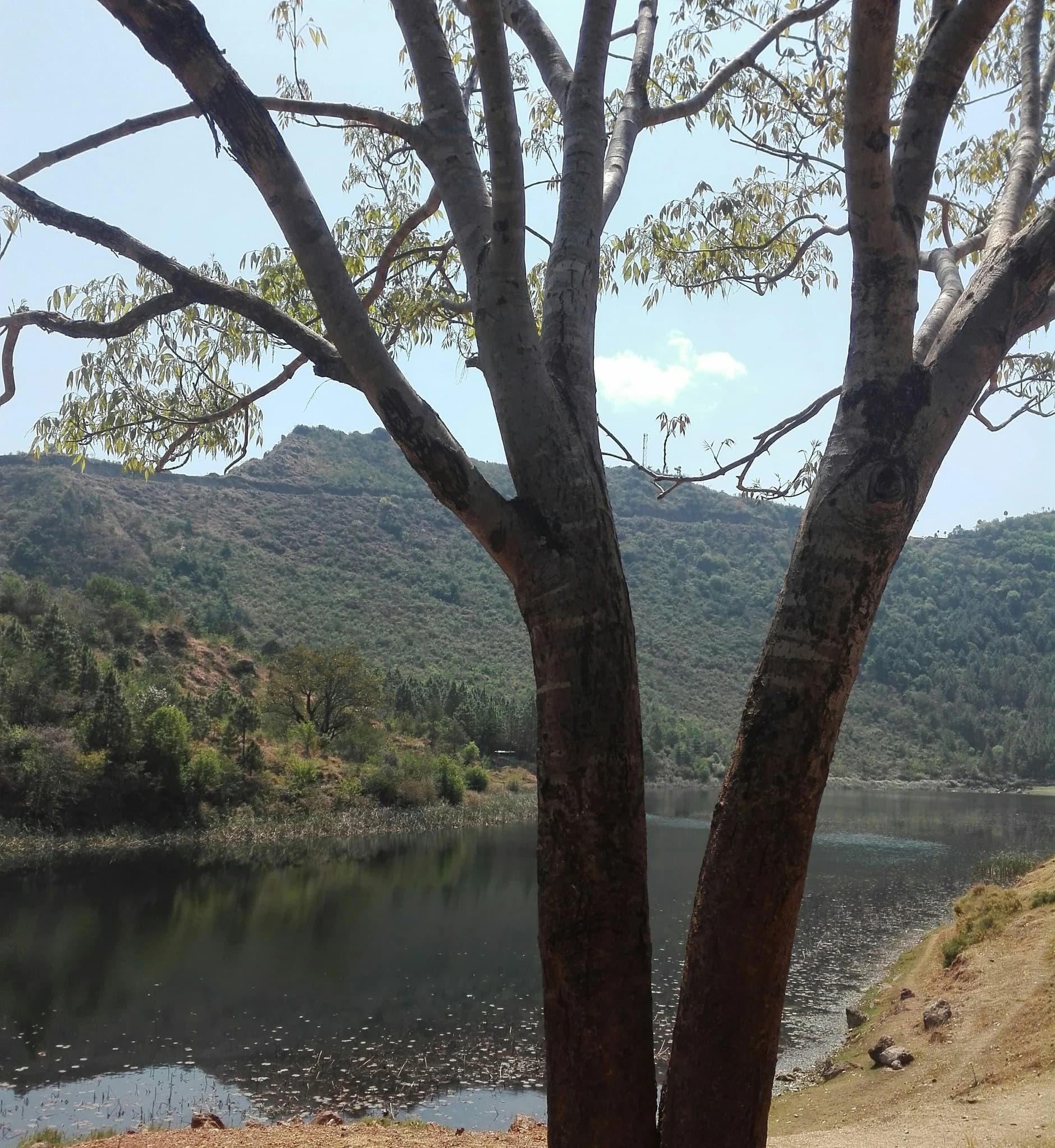
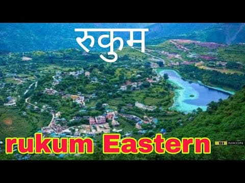
Rukmini Lake and Kamal Daha (रुक्मिणी ताल तथा कमल दह), resting gracefully in the picturesque valley basin of Rukumkot within Sisne Rural Municipality at an elevation of 1,560 meters, is the scenic, botanical, and spiritual centerpiece of Rukum East District. Famed across Nepal as 'The Lake of the Golden Lotuses', Kamal Daha owes its name to the thousands of rare native lotus flowers that carpet its tranquil waters during the warmer months, creating an enchanting natural sanctuary teeming with migratory waterfowl, aquatic flora, and serene wetland biodiversity. The lake is cradled by verdant terraced hills and traditional mid-hill settlements, reflecting the distant snow-crowned crest of Mount Sisne in its still surface during crisp autumn and winter mornings. Beyond its striking natural beauty, Rukmini Lake holds sacred pilgrimage significance for both Hindu and animist devotees. According to regional legend, the lake honors Rukmini, the consort of Lord Krishna, and is intimately linked to the ancient 'Baunni Pokhari, Trippan Kot' (52 ponds, 53 forts) cultural folklore of the historic Rukumkot principality. Devotees gather at the tranquil shoreline shrines during major religious festivals, including Maghe Sankranti, Haribodhini Ekadashi, and Shiva Ratri, to perform ritual ablutions and prayer offerings. Today, visitors can enjoy peaceful boating across the lotus ponds, stroll along stone-paved lakeside promenades, and experience warm mountain hospitality in surrounding homestays, making Kamal Daha an unmissable destination in Eastern Rukum.
Rukmini Lake and Kamal Daha (रुक्मिणी ताल तथा कमल दह), resting gracefully in the picturesque valley basin of Rukumkot within Sisne Rural Municipality at an elevation of 1,560 meters, is the scenic, botanical, and spiritual centerpiece of Rukum East District. Famed across Nepal as 'The Lake of the Golden Lotuses', Kamal Daha owes its name to the thousands of rare native lotus flowers that carpet its tranquil waters during the warmer months, creating an enchanting natural sanctuary teeming with migratory waterfowl, aquatic flora, and serene wetland biodiversity. The lake is cradled by verdant terraced hills and traditional mid-hill settlements, reflecting the distant snow-crowned crest of Mount Sisne in its still surface during crisp autumn and winter mornings. Beyond its striking natural beauty, Rukmini Lake holds sacred pilgrimage significance for both Hindu and animist devotees. According to regional legend, the lake honors Rukmini, the consort of Lord Krishna, and is intimately linked to the ancient 'Baunni Pokhari, Trippan Kot' (52 ponds, 53 forts) cultural folklore of the historic Rukumkot principality. Devotees gather at the tranquil shoreline shrines during major religious festivals, including Maghe Sankranti, Haribodhini Ekadashi, and Shiva Ratri, to perform ritual ablutions and prayer offerings. Today, visitors can enjoy peaceful boating across the lotus ponds, stroll along stone-paved lakeside promenades, and experience warm mountain hospitality in surrounding homestays, making Kamal Daha an unmissable destination in Eastern Rukum.
1 available
2 available
YouTube
Open YouTube

YouTube
Open YouTube
Discover More

Lukum (लुकुम सांस्कृतिक गाउँ), situated at an elevation of approximately 2,100 meters in Bhume Rural Municipality-1 along the Mid-Hill Highway (Pushpalal Lokmarga), is celebrated as an ancient living museum of indigenous Northern Kham Magar culture in Rukum East District. Clustered along rugged mountain terraces, Lukum is renowned for its extraordinary vernacular architecture consisting of hundreds of interconnected multi-tiered slate-and-stone dwellings where rooftops serve as communal paths and courtyards. The village preserves centuries-old animistic nature-worship traditions, traditional sheep-wool blanket weaving (Radi-Pakhi), organic subsistence agriculture, and ancestral shamanic rituals, serving as a primary host settlement for the vibrant annual Bhume Parva festivities every June.

Mount Sisne, revered locally as Sisne Himal (सिस्ने हिमाल) or 'Kanchan Himal' (कञ्चन हिमाल), stands as the iconic 5,849-meter (19,190 ft) alpine sentinel commanding the northern boundary of Sisne Rural Municipality in Rukum East District. Renowned among mountaineers and trekkers as the 'Matterhorn of Western Nepal' due to its dramatic pyramidal summit geometry, razor-sharp serrated fluted ridges, and towering, sheer rock-and-ice headwalls, Sisne Himal long remained an unclimbed holy sanctuary. For generations, the peak was held in deep spiritual awe by local Kham Magar and Khas communities, who believed the mountain to be the divine abode of protective mountain spirits. It was only in late May 2013 that an exploratory Nepali expedition led by mountain guides successfully reached its elusive summit, cementing Sisne's status in modern Himalayan exploration. The trek towards Sisne Base Camp winds through untamed high-altitude wilderness, traversing ancient rhododendron and fir woodlands, glacial river gorges, and remote trans-Himalayan pastoral rangelands inhabited by musk deer, Himalayan thar, and elusive snow leopards. Offering jaw-dropping, uninterrupted vistas across the Dhaulagiri range to the east and the rugged Kanjiroba massif to the northwest, Mount Sisne is the supreme crown jewel for adventurous trekkers seeking an unspoiled, off-the-beaten-path Himalayan frontier.

Putha Hiunchuli (पुथा हिउँचुली), also historically designated as Mount Dhaulagiri VII, stands as a colossal 7,246-meter (23,773 ft) glaciated peak crowning the northern wilderness of Rukum East District. It marks the proud western terminal bastion of the legendary Dhaulagiri Himalayan range. First summited in 1954 by legendary British explorer J.O.M. Roberts and Sherpa Ang Nyima, Putha Hiunchuli is internationally celebrated among high-altitude mountaineers as one of the most accessible and aesthetic 7,000-meter expedition objectives in the Nepal Himalayas. The trekking route to its base camp (situated at approximately 4,915 meters) traverses the untouched Kham Magar hinterlands of Putha Uttarganga Rural Municipality, passing remote highland settlements, alpine yersa pastures, and dramatic glaciated valleys framed by jagged limestone cliffs. From the base camp and summit ridges, trekkers and mountaineers are treated to an unmatched 360-degree panorama encompassing the towering west face of Dhaulagiri I (8,167m), Sisne Himal, Churen Himal, and the pristine trans-Himalayan expanse of Dolpo to the north, offering one of Nepal’s ultimate wilderness adventures.

Sundaha Lake (सुन्दह / सुनदह ताल तथा उच्च हिमाली सिमसार), tucked deep within the rugged high-alpine rangelands of Putha Uttarganga Rural Municipality in northeastern Rukum East at a dramatic altitude of approximately 4,520 meters, is one of the most pristine and sacred glacial lakes in the entire Dhaulagiri-Kham Himalayan basin. Fed by pristine permafrost meltwaters and sub-alpine mountain springs, Sundaha—literally translating to 'The Golden Lake'—reflects deep turquoise and crystal-azure hues beneath towering rocky cliffs and permanent snowfields. The surrounding alpine wetland ecosystem forms an essential ecological sanctuary, providing vital habitat and seasonal grazing grounds for alpine flora including medicinal herbs (*yarsagumba*, *panchaule*, *padamchal*) and rare Himalayan wildlife such as blue sheep (*bharal*), musk deer, and high-altitude raptors. To the indigenous Northern Kham Magar communities of Putha Uttarganga and neighboring valleys, Sundaha is revered as a deeply sacred tapobhumi and water sanctuary. During the auspicious full moon festival of Janai Purnima (Bhadra Purnima) in August, pilgrims, traditional shamans (*dhami-jhankri*), and pastoral herders undertake rigorous high-altitude pilgrimages to the lake's wind-swept banks to perform sacred cleansing ceremonies and propitiate the lake's guardian deities. Reached via rugged wilderness trails ascending from Taksera, Maikot, or the Guerilla Trek route, Sundaha offers trekkers an extraordinary combination of raw Himalayan solitude, spiritual mysticism, and pristine natural wonder.

Taksera (तकसेरा ऐतिहासिक मगर गाउँ), also commonly spelled Takasera, is the ancient cultural capital and the largest traditional settlement of the indigenous Northern Kham Magar ('Barahathare Magar') people in eastern Rukum District, situated at approximately 2,250 meters in Putha Uttarganga Rural Municipality-10. Renowned as a living anthropological museum of high-altitude Himalayan vernacular architecture, Taksera features dramatic amphitheater-like tiers of interconnected flat-roofed stone houses hand-hewn from local river rock and dark slate. In this remarkable communal architecture, the flat rooftop of one household serves seamlessly as the front courtyard and thoroughfare for the home above, connected by carved notched wooden log ladders (sanko). The settlement retains centuries-old shamanic spiritual traditions, ancient animistic nature worship, and vibrant indigenous masked folk performances, serving as the cultural epicenter of the grand annual Bhume Parva (Balpo) festival celebrated every mid-June. Surrounded by fertile terraced fields of barley, buckwheat, and potato against the dramatic backdrop of the high Dhaulagiri and Sisne ridges, Taksera offers travelers authentic community homestay hospitality, traditional hand-loomed sheep-wool textile craft (Radi-Pakhi), and acts as the historic cultural gateway for trekking expeditions toward Mount Putha Hiunchuli and Dhorpatan's alpine wilderness.