YouTube
Open YouTube
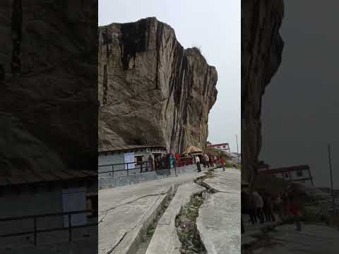
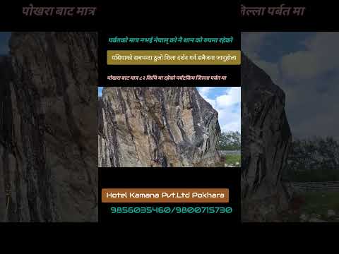
Mahashila (historically known as Golpukhar Shila), situated at an elevation of approximately 1,550 metres in Mahashila Rural Municipality Ward 5 (Lunkhu Deurali / Balakot), is an awe-inspiring natural geological wonder and one of the most revered sacred monoliths in western Nepal. Spanning across an estimated 16 ropanis (approximately 2 acres) of land, this solitary colossal limestone-granite boulder rises abruptly out of the surrounding terraced landscape. Claimed in regional folklore to be the largest monolithic boulder in South Asia, the stone is so culturally and spiritually significant that the entire rural municipality was formally named in its honor during the 2017 local governance reorganization. According to Hindu mythology and local religious folklore, the colossal stone is believed to have been transported through the sky by celestial beings during the Treta Yuga and miraculously embedded on this ridge. The rock is worshipped by devotees as a divine self-manifested (Swayambhu) form of Lord Shiva. The perimeter of the monolith features natural water recesses, ancient rock crevices, and sacrificial altars where pujas and homas have been conducted by local Brahmin and Magar priests for generations. The site transforms into a major cultural and pilgrimage center during Maha Shivaratri, Balachaturdashi, and Haribodhini Ekadashi, when thousands of pilgrims circumnavigate the massive boulder, offer bilva leaves and sacred water, and participate in vibrant folk fairs. From the high ridge encircling Mahashila, visitors are treated to expansive panoramic vistas overlooking the rolling green hills of Parbat and Syangja, with the Kali Gandaki basin winding through mountain contours far to the west.
Mahashila (historically known as Golpukhar Shila), situated at an elevation of approximately 1,550 metres in Mahashila Rural Municipality Ward 5 (Lunkhu Deurali / Balakot), is an awe-inspiring natural geological wonder and one of the most revered sacred monoliths in western Nepal. Spanning across an estimated 16 ropanis (approximately 2 acres) of land, this solitary colossal limestone-granite boulder rises abruptly out of the surrounding terraced landscape. Claimed in regional folklore to be the largest monolithic boulder in South Asia, the stone is so culturally and spiritually significant that the entire rural municipality was formally named in its honor during the 2017 local governance reorganization. According to Hindu mythology and local religious folklore, the colossal stone is believed to have been transported through the sky by celestial beings during the Treta Yuga and miraculously embedded on this ridge. The rock is worshipped by devotees as a divine self-manifested (Swayambhu) form of Lord Shiva. The perimeter of the monolith features natural water recesses, ancient rock crevices, and sacrificial altars where pujas and homas have been conducted by local Brahmin and Magar priests for generations. The site transforms into a major cultural and pilgrimage center during Maha Shivaratri, Balachaturdashi, and Haribodhini Ekadashi, when thousands of pilgrims circumnavigate the massive boulder, offer bilva leaves and sacred water, and participate in vibrant folk fairs. From the high ridge encircling Mahashila, visitors are treated to expansive panoramic vistas overlooking the rolling green hills of Parbat and Syangja, with the Kali Gandaki basin winding through mountain contours far to the west.
1 available
2 available
YouTube
Open YouTube
YouTube
Open YouTube
Discover More

Alapeshwar Cave (locally known as Alpeswor Gupha or Alapu Cave), nestled within the forested hills of Kusma Municipality Ward 7 near Gyadichaur and the Silmi forest corridor, is an extraordinary natural speleological cave network in Parbat District. Discovered in recent decades by local community members, the cave extends several hundred metres into subterranean limestone bedrock, offering an intriguing subterranean exploration destination for eco-tourists and adventure travelers. The interior of Alapeshwar Cave features multiple natural limestone chambers linked by winding rock corridors. Over tens of thousands of years, mineral-rich seepage water has sculpted spectacular calcite formations, including delicate stalactites hanging from cavern ceilings, massive stalagmites rising from the floor, flowstone curtains, and crystalline rock terraces. In several chambers, clear subterranean spring water flows over the smooth limestone floor, creating natural underground wading pools and tranquil echo chambers. Local development committees have installed solar-powered illumination along the main walking galleries, safe metal ladders, and protective handrails to facilitate visitor access without disturbing the delicate cave ecology and resident microbat colonies. Unlike heavily visited commercial caves, Alapeshwar retains a raw, uncommercialized subterranean ambiance that rewards curious travelers exploring the diverse canyon landscape of Kushma.

The Badagaun-Kaiyan Suspension Bridge (frequently referred to as the Kushma-Mudikuwa Bridge or Kaiya Suspension Bridge), spanning between Badagaun in Kusma Municipality and Kaiyan/Mudikuwa on the southern canyon plateau, is among the highest pedestrian suspension footbridges in Nepal and all of South Asia. Completed in 2013 AD (2070 BS) across the deepest section of the Modi Khola gorge, the footbridge measures 359 metres (1,178 feet) in length and hangs suspended at a staggering elevation of 156 metres (512 feet) above the river. The bridge was engineered as part of a visionary initiative to overcome the severe topographic isolation of southern Parbat's agricultural communities. Its soaring height easily surpasses ordinary suspension bridges, creating an imposing silhouette that seems almost gossamer-thin against the vast canyon landscape. Crossing the bridge gives visitors the sensation of walking through open air, accompanied by the distant roar of the Modi River echoing off vertical limestone rock faces far below. Along with its sister crossing at Gyadi and the Kali Gandaki bridge to Baglung, the Badagaun-Kaiyan bridge forms part of the renowned 'Bridge Circuit' of Kushma. Travelers often undertake a loop walk connecting all three mega-bridges in a single afternoon, experiencing three distinct canyon perspectives, panoramic mountain vistas, and the unique cultural life of the cliff-top settlements flanking the district headquarters.

Chitre Village, nestled at an elevation of 1,700 metres (5,577 feet) on the lush northwestern slopes of Mount Panchase in Modi Rural Municipality Ward 8, is the premier cultural homestay village and community eco-tourism hub of Parbat District. Inhabited predominantly by traditional Gurung (Tamu) families, Chitre is an idyllic Himalayan settlement of stone-and-mud dwellings, slate roofs, and meticulously tended organic vegetable terraces surrounded by pristine rhododendron and oak cloud forests. The village has earned national renown for its model community-managed homestay initiative. Guests are welcomed at the village gates with traditional ceremonial vermilion (tika), wild flower garlands, and the rousing rhythm of indigenous Panchebaja instruments. During their stay, visitors reside with local families, sample wholesome mountain fare—including stone-ground buckwheat rotis, millet dhindo, fresh local honey, stinging nettle soup (sisnu), and organic farm greens—and experience evening cultural gatherings featuring sacred Ghantu, Sorathi, and lively Salaijo folk songs performed around community hearths. Chitre serves as the primary Parbat trailhead for the celebrated Panchase Trek, a classic regional circuit connecting Kaski, Syangja, and Parbat. From the village terraces, hikers enjoy awe-inspiring sunrise and sunset panoramas extending across Mount Dhaulagiri (8,167 m), Annapurna South (7,219 m), Hiunchuli, and the iconic Fishtail peak (Machhapuchhre, 6,993 m). The village is also an internationally recognized orchid and rhododendron sanctuary, with over 100 species of wild orchids blooming in the surrounding protected community forests each spring.

Dahere Deurali, soaring to an altitude of 2,266 metres (7,434 feet) along the commanding ridge that borders Mahashila Rural Municipality and Phalebas Municipality in southern Parbat, is the premier high-altitude viewpoint and pilgrimage summit in the district. Renowned locally as Dahere Lekh, this dramatic windswept peak commands an unhindered 360-degree panorama of the central Himalayas, providing sweeping sunrise views of the entire Dhaulagiri massif (including Dhaulagiri I, II, III, IV, and Gurja Himal), Annapurna South, Hiunchuli, Machhapuchhre, and the Nilgiri range. At the summit sits the ancient Dahere Deurali Bhagwati Temple, a sacred open-air shrine steeped in mountain mysticism. Local faith holds that Goddess Bhagwati resided and meditated upon this peak, blessing the surrounding valleys with agricultural fertility and protection. Near the summit shrine lies a fascinating geological curiosity known as the 'Nilkantha Funnel'—a natural rock formation resembling an inverted funnel with an opening that whistles when mountain winds rush across the ridge, believed by devotees to be a manifestation of Lord Shiva's throat. Dahere Deurali is a celebrated pilgrimage destination during the Bala Chaturdashi and Chaitra Dashain festivals, when pilgrims ascend the steep stone staircases through dense rhododendron, oak, and pine woodlands to sow sacred Satbij (seven grains) and offer prayers. The trek to the summit, accessible from Lunkhu Deurali, Phalebas, or Kushma, is widely acclaimed as one of the finest day hikes in the Gandaki mid-hills.

The Kushma-Gyadichaur Suspension Bridge (locally celebrated as the Gyadi Jhula), spanning the dramatic Modi Khola canyon between Kushma Bazaar and the high fertile plateau of Gyadichaur in Kusma Municipality, is the pioneering mega-suspension footbridge that originally earned Kushma its national title as the 'City of Suspension Bridges'. Completed in 2010 AD (2067 BS), this extraordinary engineering structure spans 344 metres (1,129 feet) in length and hangs suspended 117 metres (384 feet) above the roaring rapids of the Modi River. Prior to the bridge's construction, local villagers, school children, and farmers had to undertake an exhausting two-hour descent and grueling climb through steep river cliffs to travel between Gyadichaur and Kushma. The bridge transformed local connectivity, reducing the journey to a scenic five-minute walk across the sky. Constructed using advanced high-tensile steel wire ropes, aerodynamic stabilization cables, and robust masonry anchorages, the footbridge stands as an inspiring monument to indigenous Nepalese bridge engineering. Today, the bridge is one of Parbat's most visited public landmarks and photography hotspots. Walking across its flexible steel deck provides travelers with exhilarating, vertigo-inducing views straight down into the forested canyon of the Modi Khola, while looking upstream reveals the snowy summit pyramid of Mount Machhapuchhre (Fishtail, 6,993 m) framing the valley horizon. At sunset, soft golden light illuminates the bridge cables, drawing evening strollers, tourists, and landscape photographers.

Mallaj Durbar (popularly recognized as The Heritage at Mallaj), situated on a scenic hilltop plateau at an altitude of 1,205 metres in Majhphant, Jaljala Rural Municipality Ward 2/3 of northern Parbat, is a majestic early-20th-century historical estate and one of the finest preserved architectural heritage palaces in the western mid-hills of Nepal. Constructed in 1904 AD by Colonel Tej Bahadur Malla, a distinguished military commander and royal governor, the grand estate blends classical Newari brick-and-timber craftsmanship with neoclassical Rana-era colonial palace grandeur. Perched atop a commanding ridge overlooking the Kali Gandaki and Rahughat river valleys just across from Beni, the durbar complex features thick sun-dried brick masonry walls, grand pillared verandahs, hand-carved wooden windows and lintels, and wide stone-paved inner courtyards. After decades of dormancy, the palace was meticulously restored by the descendants of Colonel Malla using traditional materials and skilled heritage artisans, preserving its original architectural integrity while welcoming travelers as an exclusive heritage retreat. The surrounding village of Mallaj is famous across western Nepal for its extensive hillside orange orchards, sweet winter citrus harvests, and tranquil rural charm. Guests strolling the estate grounds are treated to magnificent panoramic vistas of Mount Dhaulagiri (8,167 m), Tukche Peak, and the Nilgiri range rising directly to the north, making Mallaj Durbar a premier destination for cultural heritage enthusiasts, history scholars, and discerning travelers seeking peaceful historical immersion.