YouTube
Open YouTube
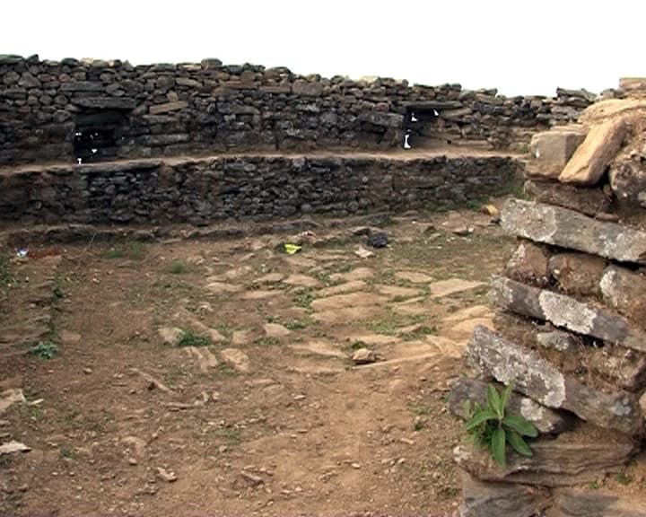
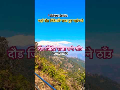
Ligligkot Fort, commanding an imposing 1,440-meter strategic ridge in Palungtar Municipality of western Gorkha, occupies a unique and legendary chapter in the political history of Nepal. Before the unification era, Ligligkot was an independent principality ruled by local Ghale kings chosen through an extraordinary annual ritual: an open sprint race called the 'Liglig Daur' held during the Dashain festival. Whosoever ran from the Chepe River confluence (Chepeghat) up the grueling mountain ridge to the fort summit first was crowned monarch for the upcoming year. In 1559 AD, Prince Dravya Shah, the younger son of King Yashobrahma Shah of neighboring Lamjung, seized upon this tradition. With the backing of key local chieftains and ministers including Ganesh Pande, Bhagirath Panta, and Sarbeshwar Khanal, Dravya Shah entered the contest, triumphed, and established the Shah dynasty royal seat at Ligligkot, laying the foundational springboard from which Gorkha expanded. Today, the site preserves historic stone fortification ramparts, royal palace foundations, a Kot temple dedicated to Kalika, sacred stone statues, and the traditional flag post where kings were anointed. Every autumn, Palungtar Municipality and sports organizations organize the national 'Liglig Daur' marathon, reenacting the historic 13.5-kilometer race from Chepeghat to Ligligkot top, drawing athletes and spectators from across Nepal. Beyond its deep historical resonance, Ligligkot rewards visitors with one of the most comprehensive 360-degree panoramic vantage points in central Nepal. Looking north and northwest, the skyline is dominated by the colossal snow peaks of the Annapurna massif, Lamjung Himal, Mount Manaslu, Himalchuli, and Buddha Himal, while fertile green valleys carved by the Marshyangdi and Chepe rivers unfold thousands of feet below.
Ligligkot Fort, commanding an imposing 1,440-meter strategic ridge in Palungtar Municipality of western Gorkha, occupies a unique and legendary chapter in the political history of Nepal. Before the unification era, Ligligkot was an independent principality ruled by local Ghale kings chosen through an extraordinary annual ritual: an open sprint race called the 'Liglig Daur' held during the Dashain festival. Whosoever ran from the Chepe River confluence (Chepeghat) up the grueling mountain ridge to the fort summit first was crowned monarch for the upcoming year. In 1559 AD, Prince Dravya Shah, the younger son of King Yashobrahma Shah of neighboring Lamjung, seized upon this tradition. With the backing of key local chieftains and ministers including Ganesh Pande, Bhagirath Panta, and Sarbeshwar Khanal, Dravya Shah entered the contest, triumphed, and established the Shah dynasty royal seat at Ligligkot, laying the foundational springboard from which Gorkha expanded. Today, the site preserves historic stone fortification ramparts, royal palace foundations, a Kot temple dedicated to Kalika, sacred stone statues, and the traditional flag post where kings were anointed. Every autumn, Palungtar Municipality and sports organizations organize the national 'Liglig Daur' marathon, reenacting the historic 13.5-kilometer race from Chepeghat to Ligligkot top, drawing athletes and spectators from across Nepal. Beyond its deep historical resonance, Ligligkot rewards visitors with one of the most comprehensive 360-degree panoramic vantage points in central Nepal. Looking north and northwest, the skyline is dominated by the colossal snow peaks of the Annapurna massif, Lamjung Himal, Mount Manaslu, Himalchuli, and Buddha Himal, while fertile green valleys carved by the Marshyangdi and Chepe rivers unfold thousands of feet below.
1 available
2 available
YouTube
Open YouTube
YouTube
Open YouTube
Discover More

Barpak Village, perched like an ancient mountain amphitheater at an altitude of 1,900 to 1,950 meters in Barpak Sulikot Rural Municipality, is one of the most culturally distinguished and historically prominent settlements in central Nepal. Dominated primarily by the indigenous Ghale and Gurung communities, Barpak has long been renowned for its fierce martial traditions, unique social structures, and stone-roofed architectural heritage. It is famously celebrated as the ancestral home of late Captain Gaje Ghale, who was awarded the prestigious British Victoria Cross for extraordinary gallantry in Burma during World War II. On April 25, 2015, Barpak became globally known when the catastrophic 7.8-magnitude Gorkha Earthquake struck with its epicenter located directly beneath the village, flattening nearly all of its 1,200 traditional slate-roofed stone houses. Through remarkable communal solidarity, resilience, and reconstruction assistance, the village has emerged rebuilt, featuring earthquake-resilient stone and wood architecture while preserving its traditional stone-paved lanes, chortens, and communal water fountains. Today, Barpak operates as a vibrant rural community homestay destination. Visitors are welcomed into local homes where they experience authentic Gurung hospitality, sample organic buckwheat rotis, wild mountain honey, and locally grown nettle soup, and witness traditional weaving of nettle-fiber fabrics (Allo) and wool blankets (Radi-Pakhi). Communal evenings feature cultural Ghantu, Maruni, and Sorathi dances performed around wood hearths. Perched high above the Daraudi River valley, Barpak offers magnificent vistas of Mount Buddha Himal (6,692 m) and Mount Sringi. It serves as an essential acclimatization stop and cultural hub along the lower Manaslu cultural trek connecting to Laprak and Dharche Danda.

Birendra Tal (Birendra Lake) is a breathtaking high-altitude freshwater glacial lake situated at an elevation of 3,691 meters (12,110 feet) in Chumanuwri Rural Municipality, Gorkha District. Named in honor of Nepal's late King Birendra Bir Bikram Shah, the lake is situated at the snout of the vast Manaslu Glacier, nestled within a dramatic bowl formed by lateral moraines beneath the towering peaks of Mount Manaslu (8,163 m) and Naike Peak. The lake is fed directly by meltwater, ice seracs, and mineral-rich glacial silt calving from the Manaslu icefall. This glacial flour gives Birendra Tal its brilliant, opaque turquoise-emerald coloration, which shifts in hue depending on the angle of sunlight and the season. Floating icebergs and chunks of glacial ice often drift silently across its chilly surface. Located approximately 1.5 to 2 hours of gentle walking northwest of Samagaun, Birendra Tal is one of the most accessible and rewarding day-hike acclimatization excursions for trekkers on the Manaslu Circuit. The trail leads through fragrant alpine birch, pine, and juniper woods, crossing wooden bridges over glacial meltwater channels before climbing the moraine crest overlooking the lake. The pristine alpine setting, with sheer granite mountain spires reflecting in the still turquoise water and the amphitheater of Mansiri Himal giants standing in the background, makes Birendra Tal one of the premier landscape photography landmarks in the entire Nepalese Himalayas.

Gorkha Durbar (Gorkha Palace) is the ancestral fortress-palace of Prithvi Narayan Shah, the king who unified the various kingdoms of the Himalayan foothills into the nation of Nepal in 1768 CE. Perched dramatically on a ridgeline above Gorkha Bazaar at approximately 1,100 metres, the palace complex commands panoramic views over the surrounding hills and valleys, with the Manaslu and Ganesh Himal ranges visible on clear days. The Durbar complex consists of a multi-roofed Newari-style palace building, the Gorkha Kalika Temple (a cave temple dedicated to the goddess Kali, accessible only to Hindus), and the Dhuni Pati -- a shrine housing an eternal flame said to have burned since the time of Prithvi Narayan Shah's ancestors. The palace building displays exceptional Newari woodcarving craftsmanship with elaborately carved struts and window lattices. Gorkha is the origin of both the name and the founding of modern Nepal, and remains deeply connected to national identity. The town is also the namesake of the renowned Gurkha soldiers who have served in the British and Indian armies for over 200 years. The palace is reached by a 20-minute uphill walk (approximately 1,400 stone steps) from the bazaar, or by a shorter route from a higher road access point. The site was damaged in the 2015 earthquake but has been restored. Entry fee applies; guides available. Gorkha Bazaar is 4-5 hours from Kathmandu and 1-2 hours from Pokhara by road.

The Gorkha Museum, housed inside the historic grand palace known as Tallo Durbar (Lower Palace), stands as a prime monument of Nepalese history at the base of the palace hill in Pokharithok, Gorkha Municipality. Built in 1835 AD (1892 BS) during the reign of King Rajendra Bikram Shah and the premiership of Mukhtiyar Bhimsen Thapa, this magnificent red-brick complex represents one of the finest preserved examples of 19th-century Newari secular architecture constructed outside the Kathmandu Valley. Spanning an expansive courtyard (Thulo Aangan), the palace features masterfully carved wooden window frames (Tikijhya and Sanjhya), heavy timber rafters, ornamental brick facades, and fortified outer gateways. Following extensive conservation by the Department of Archaeology, the complex was inaugurated as a public museum to preserve and showcase the martial, royal, and socio-cultural legacy of the Shah unification era led by King Prithvi Narayan Shah. Inside its twelve specialized exhibition galleries, visitors encounter an extraordinary treasury of historical artifacts. The arms and armor gallery displays authentic 18th-century matchlock rifles, flintlocks, heavy bronze cannons, iron shields, ceremonial khukuris, curved talwars, and personal chainmail armor used by Gorkhali warriors during national military campaigns. Additional halls feature rare Shah dynasty coinage, royal palm-leaf and copper inscriptions, hand-painted genealogy scrolls (Vamshavalis), religious thangka paintings, and everyday traditional artifacts of the Magar, Gurung, and Newar ethnic communities. Surrounded by meticulously manicured gardens, stone pathways, and shade trees, the museum provides essential historical context before visitors make the uphill stone ascent to the ancestral upper fortress of Gorkha Durbar. It serves as both an indispensable educational resource and an evocative journey into the origins of modern Nepal.

Laprak Village is an extraordinary and resilient Gurung mountain settlement located in Dharche Rural Municipality of northern Gorkha. Perched on sheer mountain slopes at 2,100 meters, the traditional ancestral village of Laprak consists of tiered wooden-and-stone houses cascading dramatically down the mountain ridge above the Machha Khola and Budhi Gandaki river gorges. Laprak is renowned for its preservation of authentic shamanic Bon and Buddhist spiritual practices, traditional animal husbandry, and communal solidarity. Following severe slope instability and damage during the 2015 earthquake, a landmark integrated model settlement was constructed at Gupsi Danda (2,700 m) on the alpine plateau above the old village through an initiative spearheaded by the Non-Resident Nepali Association (NRNA) in collaboration with the Nepal Army. The Gupsi Danda model village features nearly 600 uniformly designed red-roofed, earthquake-resilient stone cottages arranged neatly with solar power, communal water systems, and medical facilities. Visiting Laprak allows travelers to witness this unique juxtaposition between the historical ancestral cliff village and the modern alpine model settlement. During the summer and harvest seasons, villagers tend vast terraced fields of barley, buckwheat, and mountain maize, and graze yaks and sheep in the high pastures. Surrounded by dense virgin forests of rhododendron, pine, and birch, Laprak provides commanding vistas across northern Gorkha. It serves as a prime staging base for ascending the nearby 3,220-meter viewpoint of Dharche Danda, and an unforgettable stop along the Manaslu Lower Circuit cultural trail.

Larkya La Pass (also spelled Larke Pass), crossing at a towering elevation of 5,106 meters (16,752 feet, often marked 5,160 m), is the dramatic geographic climax and crowning achievement of the epic Manaslu Circuit trek. Situated on the glaciated mountain crest of northern Gorkha, Larkya La marks the high alpine boundary connecting Chumanuwri in Gorkha District with the Marshyangdi river valley in neighboring Manang District. The push over Larkya La typically begins before dawn from the high stone shelter of Dharmasala (Larke Phedi, 4,460 m). Trekkers climb steadily under starlight across moraine ridges, navigating lateral glacial basins, frozen alpine tarns, and fields of loose scree with crampons or trekking poles. Cresting the pass reveals a fluttering maze of Buddhist prayer flags, Mani stones, and a metal signpost celebrating the 5,106-meter milestone. The panoramic view from the summit of Larkya La is universally ranked among the most magnificent in the Himalayas. Looking east toward Gorkha, the jagged spire of Larkya Peak and Mount Manaslu dominate the skyline. Looking west toward Manang and the Annapurnas, a breathtaking amphitheater of giant glaciated summits unfolds, including Himlung Himal (7,126 m), Cheo Himal (6,820 m), Gyaji Kang, Kang Guru (6,981 m), and the colossal mass of Annapurna II (7,937 m). The descent from the pass drops steeply over 1,500 vertical meters into the pristine alpine meadow of Bimthang, passing turquoise moraine lakes and ancient pine forests, concluding one of the greatest mountain traverses on Earth.