YouTube
Open YouTube
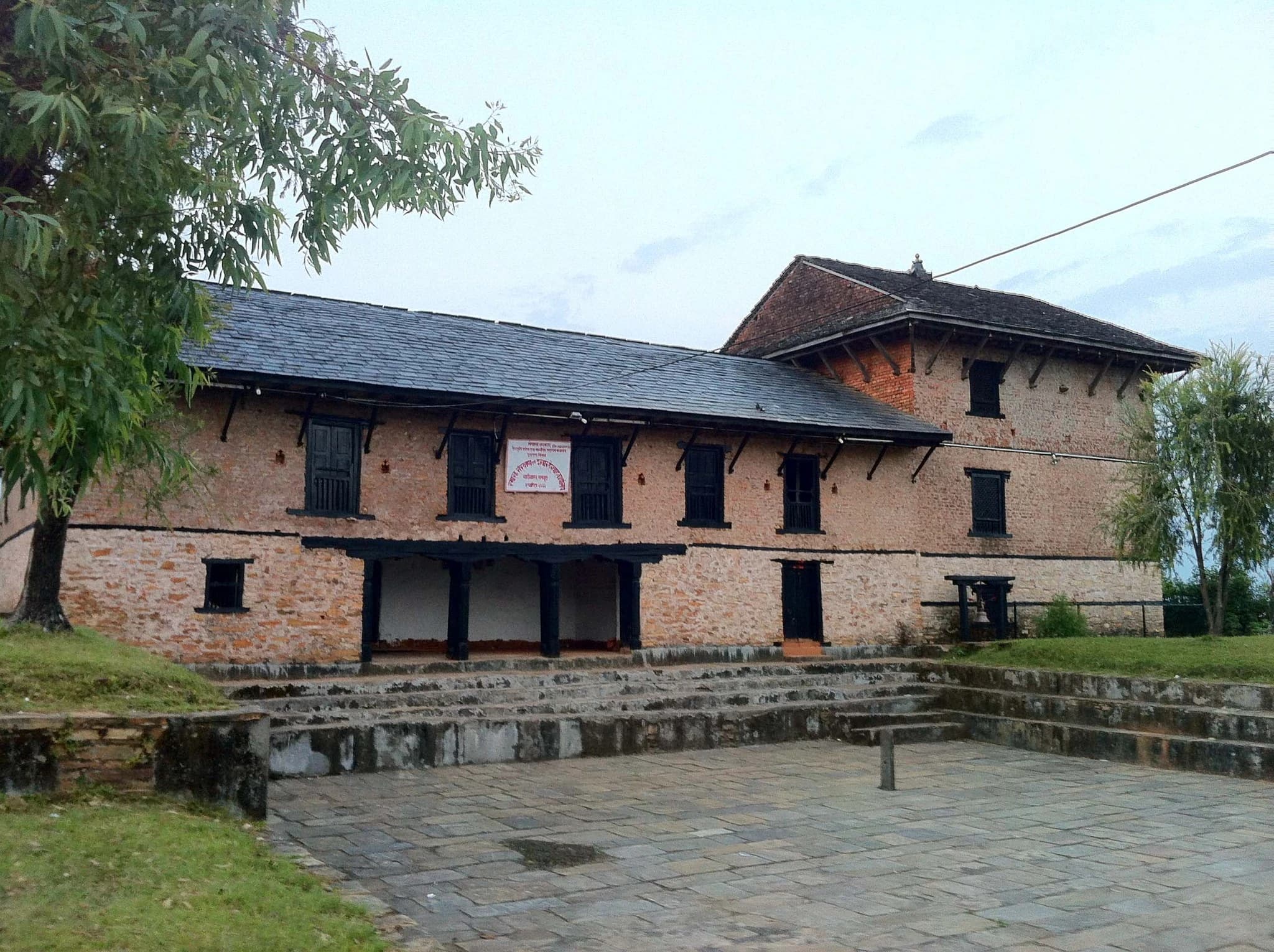
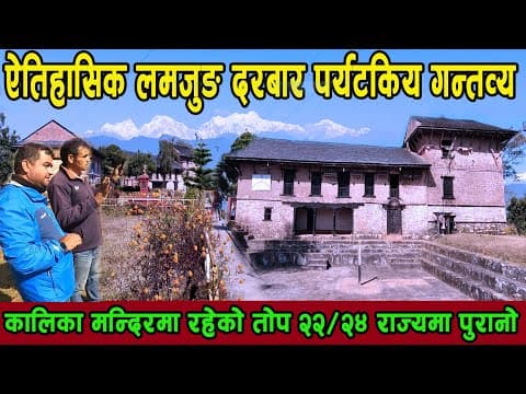
Lamjung Durbar, commanding a high ridge at 1,500 metres in Gaunsahar (Besisahar Municipality Ward 3), is one of the foundational historical monuments in the modern history of Nepal. Constructed in the 16th century by King Yashobrahma Shah, this ancient stone fortress served as the royal palace and capital of the historic Kingdom of Lamjung before the Shah dynasty expanded into Gorkha. It was here that Prince Dravya Shah and King Narahari Shah were born and raised, laying the political and military groundwork that culminated two centuries later in the unification of Nepal. The durbar complex features rugged dry-stone masonry, thick defensive walls, ancient wooden pillars, and traditional multi-tiered pagoda roofs. Within its sacred inner courtyards stand the revered temples of Lamjung Kalika and Lamjung Gadi. The Kalika Temple is especially famous across western Nepal: during the great festival of Dashain (Chaite Dashain and Bada Dashain), thousands of pilgrims ascend the stone staircases to offer prayers, red vermilion, and ritual sacrifices to the royal guardian goddess. The complex also preserves a historic subterranean armory where centuries-old matchlocks, shields, royal copperplate inscriptions, and ritual khukuris are guarded by local caretakers. Perched atop the Gaunsahar ridge high above the Marshyangdi river valley, Lamjung Durbar provides an exceptional 360-degree viewpoint commanding vistas of Besisahar town, terraced valleys, and the soaring, ice-fluted south ridge of Mount Lamjung (6,988 m).
Lamjung Durbar, commanding a high ridge at 1,500 metres in Gaunsahar (Besisahar Municipality Ward 3), is one of the foundational historical monuments in the modern history of Nepal. Constructed in the 16th century by King Yashobrahma Shah, this ancient stone fortress served as the royal palace and capital of the historic Kingdom of Lamjung before the Shah dynasty expanded into Gorkha. It was here that Prince Dravya Shah and King Narahari Shah were born and raised, laying the political and military groundwork that culminated two centuries later in the unification of Nepal. The durbar complex features rugged dry-stone masonry, thick defensive walls, ancient wooden pillars, and traditional multi-tiered pagoda roofs. Within its sacred inner courtyards stand the revered temples of Lamjung Kalika and Lamjung Gadi. The Kalika Temple is especially famous across western Nepal: during the great festival of Dashain (Chaite Dashain and Bada Dashain), thousands of pilgrims ascend the stone staircases to offer prayers, red vermilion, and ritual sacrifices to the royal guardian goddess. The complex also preserves a historic subterranean armory where centuries-old matchlocks, shields, royal copperplate inscriptions, and ritual khukuris are guarded by local caretakers. Perched atop the Gaunsahar ridge high above the Marshyangdi river valley, Lamjung Durbar provides an exceptional 360-degree viewpoint commanding vistas of Besisahar town, terraced valleys, and the soaring, ice-fluted south ridge of Mount Lamjung (6,988 m).
1 available
2 available
YouTube
Open YouTube
YouTube
Open YouTube
Discover More

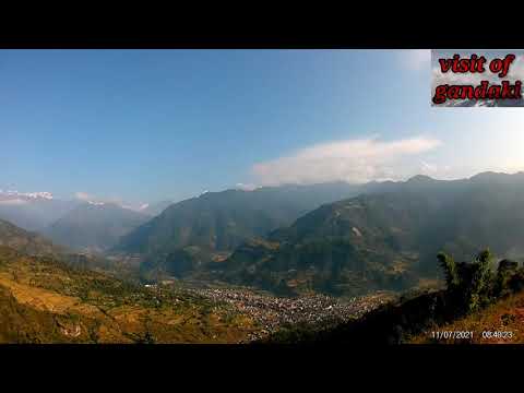
Bahundanda, perched prominently on a dramatic 1,310-metre mountain saddle in Marsyangdi Rural Municipality Ward 3, is an iconic and visually stunning traditional hill settlement along the classic Annapurna Circuit route in Lamjung. Meaning 'Brahmin Hill' in Nepali, the village was historically settled on a strategic ridgeline commanding 360-degree views up and down the Marshyangdi River canyon. The defining aesthetic feature of Bahundanda is the staggering amphitheater of sculpted green rice paddies that plunge thousands of feet down steep ridgelines to the river gorge below. These masterfully engineered agricultural terraces, cultivated by generations of Gurung and Brahmin farming families, represent one of the most remarkable human-shaped landscapes in rural Nepal. The village itself features a charming stone-paved main street lined with traditional slate-roofed teahouses, schoolhouses, small shrines, and welcoming community lodges shaded by majestic pipal trees and prayer flags. Trekkers ascending from Bhulbhule climb a steep stone staircase to reach the village crest, where they are rewarded with refreshing cool breezes, panoramic river vistas, and traditional hospitality before continuing into the higher reaches of northern Lamjung.

Besisahar, located at an altitude of 760 metres along the banks of the roaring Marshyangdi River, is the administrative headquarters of Lamjung District and world-renowned as the historic starting point (Kilometer 0) of the iconic Annapurna Circuit trek. Surrounded by lush, green terraced hillsides, subtropical bamboo groves, and limestone cliffs, the town has welcomed international mountaineers, trekkers, and explorers from every corner of the globe for over five decades. Before modern mountain roads connected into upper Manang, every Annapurna Circuit trekker began their multi-week journey on foot right from the cobblestone streets of Besisahar. Today, the town remains the vital logistics, supply, and transportation nerve center of northern Gandaki Province. Here, travelers acquire Annapurna Conservation Area Project (ACAP) and TIMS permits, hire licensed mountain guides and porters, purchase trekking gear, and board mountain jeeps heading into the high Himalayan valleys of Chame and Manang. Beyond its role as a bustling trekking trailhead, Besisahar offers charming cultural viewpoints and peaceful river walks. The town hosts the sacred Bhimsen Mandir, cultural parks, and weekly agricultural markets where highland Gurung farmers trade produce with valley residents. It also serves as the ideal springboard for day hikes ascending to Lamjung Durbar, Kaulepani, and Purankot.

Bhujung Village, situated at an altitude of 1,690 metres in Kwholasothar Rural Municipality, is the largest single nucleated Gurung settlement in Lamjung District and one of the most architecturally fascinating cultural villages in Nepal. Unlike other Himalayan villages that are scattered across open hillsides, Bhujung is built as a single, fortress-like amphitheater of more than 300 tightly packed, slate-roofed stone houses clinging harmoniously to a steep hillside above the Midim Khola valley. The village has remarkably preserved its traditional social structure, local governance, and ancient Tamu customs for centuries. Clan elders enforce traditional community forestry laws, communal labor exchange systems (Parma), and historic environmental bylaws. The stone alleys winding between the stone houses are so compact that roofs often overlap, creating covered stone passages and intimate community courtyards where villagers dry grain, weave traditional bamboo baskets (Doko and Thunche), and spin local sheep wool. Bhujung is entirely self-sufficient in renewable energy, operating its own community micro-hydroelectric power plant and local drinking water grid. The village features extensive terraced fields of mountain paddy and millet, an experimental community tea estate, the sacred Kaiyo waterfall, and nearby wild cliff-honey hunting sites where courageous local harvesters descend hundreds of feet down sheer cliffs on handmade rope ladders. Surrounded by lush oak and rhododendron forests with views opening toward Lamjung Himal and the Annapurna range, Bhujung provides travelers with an authentic, uncommercialized window into centuries-old Himalayan rural life.

Chamje Waterfall, plunging powerfully down sheer granite cliffs at an elevation of 1,430 metres in Marsyangdi Rural Municipality Ward 4, is one of the most dramatic and awe-inspiring natural landmarks along the classic Annapurna Circuit trekking route in northern Lamjung. Situated directly across the Marshyangdi river gorge from the stone lodge settlement of Chamje, the waterfall thunders hundreds of vertical feet down a narrow vertical rock cleft, generating billowing clouds of cool mist that drift across the canyon. The waterfall is fed by perennial high-altitude glacial snowfields and pristine alpine streams descending from the eastern ridges of Lamjung Himal. As the torrent crashes over successive rock benches into a turbulent plunge pool at the gorge floor, it creates a sensational natural spectacle that captivates every traveler ascending the canyon. Geographically, Chamje Waterfall marks the dramatic natural gateway where the topography transitions from the green, terraced subtropical valleys of lower Lamjung into the steep, vertical-walled alpine gorges that lead toward Manang District. Trekkers cross dramatic steel suspension bridges slung high above the churning Marshyangdi river, taking rest at roadside viewpoints and tea stalls to photograph the tumbling waters set against soaring Himalayan cliffs.

Dudhpokhari Lake, situated at an exhilarating elevation of 4,560 metres (14,960 feet) in northern Dudhpokhari Rural Municipality, is one of the most sacred high-altitude glacial lakes and trekking destinations in the western Himalayas of Nepal. Named 'Dudhpokhari' (literally 'Milky Lake') due to the unique cloudy-white appearance of its mineral-rich glacial meltwater, the lake sits enclosed within a dramatic alpine amphitheater near the tri-junction boundary of Lamjung, Gorkha, and Kaski districts. The lake holds immense spiritual significance in both Hindu and Buddhist traditions. According to regional mythology, taking a holy ritual dip in Dudhpokhari washes away a lifetime of sins and grants spiritual liberation. During the sacred full-moon festival of Janai Purnima in August, thousands of pilgrims, sadhus, and traditional Gurung and Magar shamans (Jhankris) trek through high mountain passes in sacred trance, beating drums and offering prayers to Lord Shiva and mountain deities at the water's edge. From a trekking perspective, Dudhpokhari represents an extraordinary off-the-beaten-path wilderness expedition. The route ascends through dense sub-alpine rhododendron and bamboo woodlands, traversing rocky ridgelines and high yak pastures where shepherd huts (Goths) dot the landscape. The lake sits directly beneath the massive, glaciated south walls of Mount Himalchuli (7,893 m) and Buddha Himal (6,692 m), offering awe-inspiring mountain solitude and unblemished natural purity.

Ghalegaun, nestled at an elevation of 2,095 metres (6,873 feet) in Kwholasothar Rural Municipality of Lamjung District, is widely celebrated as one of the most successful and picturesque community homestay destinations in South Asia. Perched high on the southern slopes of Lamjung Himal, the village was formally recognized by the South Asian Association for Regional Cooperation (SAARC) as a model eco-tourism village, setting a pioneering benchmark for authentic community-based cultural tourism in Nepal. Inhabited predominantly by the ethnic Gurung (Tamu) community and historic Ghale clans, Ghalegaun features neatly aligned traditional slate-roofed stone cottages connected by pristine stone-paved pathways. Visitors are greeted at the village gate with traditional vermilion (tika), flower garlands, and local brass musical welcomes. During their stay, guests reside inside traditional family homes, sample organic farm-to-table cuisine—such as local buckwheat rotis, millet porridge (dhindo), organic honey, and homegrown sukuti—and observe vibrant evening cultural performances including the sacred Ghantu, Sorathi, and Krishna Charitra dances performed by village elders in ancestral regalia. The village commands an awe-inspiring, close-up panoramic vista of the northern Himalayan giants. Looking across the valley at sunrise, visitors are treated to brilliant views of Mount Lamjung (6,988 m), Annapurna II (7,937 m), Annapurna IV (7,525 m), Machhapuchhre (Fishtail, 6,993 m), Mount Manaslu (8,163 m), Himalchuli, and Buddha Himal. A community tea garden, cultural museum displaying ancient Gurung weaving looms and weaponry, and sacred view towers make Ghalegaun a must-visit cultural immersion destination.